
Pugilists spotted while strolling from Hyde Park Corner to Harrods on Knightsbridge or Brompton Road, London, 9 June 2014.
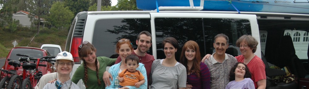
Pugilists spotted while strolling from Hyde Park Corner to Harrods on Knightsbridge or Brompton Road, London, 9 June 2014.
Friday 16 May 2014

From Bath to Cotswolds to London

Memorable Bath YSA Hostel
We got out of Bath by 10am this morning, grateful for a little extra rest after a midnight cessation of activities.
After much ado about the popularity of touring the picturesque villages of the Cotswolds of Gloucestershire, we found that the native tourists were out in force, occupying tea rooms and gaily enjoying their paradise, but I have to confess that it was all a bit over-rated. My favorite part of the day was experienced as we down between hill and hollow in the downs between Cirencester and Stow. Along narrowing tracks, we passed through gleaming fields of mustard and green, into deep hollows, through new forests of distinct trees planted too dense, and around little hamlets with few homes. These were the kinds of places to walk and ride, but it all passes too quickly in a car, and although lost for a while, we eventually found our way back to the A429 heading towards Stow. Stow-on-the-Wold passed in a blink of an eye when we failed to turn into the maze of the City Center.

Content at Moreton-in-Marsh

Colorful toy shop

Quaint Cotswold villages

Chipping Campden country homes
But we did park and explore Moreton-in-Marsh, poking our heads into knick-knackery shops, stopping for ice cream at the Sweet Shop, and exploring a delightful toy shop where Rachel found a prize. A pass by Boureton and passing through and back in Chipping Campden completed our Cotswolds tour, making more of the elegant thatched roofs and other quaint architecture that my quest for adventure craves. Indeed, the road, with its challenges to navigation, was fulfillment enough. Also, the passage was enhanced when the road was viewed through the rose colored spectacles of a new mystical fantasy about stone mages (Kelli Swofford Nielsen’s Journey to the Fringe) that played on our imaginations on CD. This story, as Rachel was so correct in proclaiming, would be something that Daniel would love, due to its claim to magical powers enhanced by gem talismans.
But the day was warm and clear which made for a jolly good time in what could have been dismal and damp. At 1:00pm, we turned our boat out of the Vale of Evesham onto A44 towards Oxford, circumvented that great destination without time to explore its enchantments, and pursued our course onto the M40, A40, and all the traffic headed into the center of London. It was with some trepidation that we just followed our nose because our navigational Mapquest aids were wholly incorrect until we reached the end of the road at Marylebone and followed that road into dense traffic onto Euston, confirming at last that we had overshot our mark. Returning whence we came, we found Seymour Place and after a few trips around the Harrowby block, found street parking on Bryanston off Shouldham where I left the girls and endeavored on foot to find Richbourne Court, encountering Miles pushing a new wheelchair purchased for Ralph.
And thus ended the 1,500 miles 5 day countryside tour of rural southern England.

London views from the backseat driver
Thursday 15 May 2014
Borth, Ceredigion, Wales to Bath, Gloucester, England

Devil’s Bridge & Falls

Rheidol Gorge
Having traversed Wales from south to north, we now steered a course from the Irish Sea eastward across Wales to the Brecon Beacon highlands and down to the Severn Estuary and back into the midlands of England.
Reaching a sign to Devil’s Bridge (Pontarfynach), we enjoyed a pleasant diversion as we followed narrow roads into high villages. The trail down to the falls down in a very steep and deep little gorge of the Rheidol and Mynach creeks was accessed by slate steps to view stunning falls and bridges built upon bridges. Following a side track, I found that the undergrowth beneath the forest wash soft and deep, a wonderful wild place of many unfamiliar plants.
Searching for Sarah Bunton’s Luxury Chocolates, we searched high and low to no avail in four directions from Y Caban, the village adjacent to Devil’s Bridge. The search, though unfruitful, gave us purpose and was fulfilling in that it allowed us to appreciate the splendor of this splendid highland with its isolated hamlets and farms.

High Pastures in the Brecon Beacons
Turning into the visitor center at Brecon Beacons National Park was a bit of a letdown. There isn’t really much to these “mountains”, but to hear a local Welshman rave on about the majesty of the heights to his foreign mates made me salivate. The nearby peaks were only just over 800’ in elevation, with gradual prominence, and even the glacial valleys of the Black Mountains above Crickhowell were scenic, but not at all wild or awe inspiring. Heading off the main highway in the valley of the Usk River we wound through narrow lanes past Pencelli Castle (Penkethli) and around a picturesque village at Talybont-on-Usk before returning to the highway and continuing past Bwlch (Bulk) to Crickhowell (Crug Hywel). There, I sought higher ground in the longest vale that penetrates the Black Mountains (Mynyddoeff Duon), threaded along Gwyne Foch to the head of glacial valley past tiny creekside outposts at Llangenny and Llangenau. Though steadily climbing, the vistas obscured by flowery hedgerows along narrow roads got narrower and narrower and ever winding until still 8 miles from the end of road and the Priory, I lost heart and turned around lest the lane, barely wide enough for a single car, would require backing down 300 yards. This would have been a wonderful for a bike ride, but not a fit passage for an automobile, and I’m sure that Susan approved of my turnabout.

Thai Dinner along Avon River in Bath
Following the Usk River valley, I enjoyed this south facing slope, but I preferred the highlands and forests of the Cambrian Mountains. Dropping down to Newport through Pontypool and Cwmbran, we rejoined the motorway and soared back over the Severn Bridge out of southern Wales into Gloucestershire, circumvented Bristol, and proceeded into the midlands and the city of Bath, a university town. In this World Heritage City, famous for its Roman steam baths, sprawing over sizable hills along the Avon, and we enjoyed a fine Thai dinner at Salathai after locating our accommodations on Bathwick Hill after failing to find it on Claverton Hill. For all their Brecon Beacons National Park acclaim, it appeared to me that the prominence of the hills around Bath exceeded the gradient we had crossed through the Brecons, and I found this surprising that a city in the Midlands could have such steep elevation changes. Indeed, the altitude of the River Avon lies at about 59’ and the highest hill in Bath is at 781’, making for a 700’ prominence.
Bees, of a large black variety that were slow and curious, buzzed about our faces at the entrance to our dorm, but signs warned us to stay calm and not harm them as they are protected due to decline caused by foreign competition. After an initial bout of screaming, it took some effort to calm Rachel down and learn to ignore them.

Llandudno
Wednesday evening 14 May 2014
After a lengthy tour of Penrhyn castle and a brief diversion through Llandudno on a small peninsula north of Anglesey, we stopped for dinner supplies at a Welsh Farm Food attraction, then pressed back on up and over the mountains past Betws-y-Coed (Betis-y-coid) back to Dolgellau through idyllic Cymru countryside, turning aside towards Borth, and finding ourselves on a seaside lane facing the setting sun in a hostel where only one other couple was residing.

Borth Village
My first stop was to climb the promenade seawall and approach the shore of cobblestone on sand facing west into a bright sunset on a shallow shore of calm water with minor swells. A peaceful shore, but not beachy, it was not appealing for swimming, but for dreaming. We ate well and slept well, enjoying some television viewing and Ben and Jerry’s Fish Food ice cream purchased at discount from the Family Store down the lane.

Borth beaches

Walled Garden
Wednesday afternoon 14 May 2014
Penrhyn Castle walled garden

Stunning shrubbery

Fancy dancers

Translucent leaves

Swamp foliage

In the jungle

Fantasy Castle
Although a newer 18th century Norman castle, it was impressive in all aspects and commanded our attention for several hours, exploring all the rooms, taking many pictures, and also hiking about the walled garden and boggy garden. Grotesque faces and motifs were repeated throughout, making it interesting, but macabre. What an enormous amount of wealth was invested into this monumental residence! Enjoy this collage of fantasy images!

Tinted Towers

Delicious interiors

Arch symmetry

Fancy carvings

Toothy grins

Leering faces

Spiral staircases to deep dungeons

Stained Glass

Framing the light

Playing with light

Climbing Vines

Battlements

Penrhyn Castle

Penrhyn Vistas

Portraits

Slate majesty

Stiles, slate mines, black hills, & rusty roots
Wednesday 14 May 2014 dawned lazy so we made no rapid escape from Llanberis moody vale of narrow lakes and slate mines at the foot of Yr Wyddfa (Snowdon).

Llanberis moods & campgrounds
I took a short walk up the lane and explored muddy sheep pastures and paths through camping grounds and on stiles over rock walls as hikers explored their maps and GPS also in search of the paths through shepherd’s fields that lead to the Snowdon trail.

Sheep & Rams & Bonny Brook
Fenced in cascades filled with debris were nonetheless scenic, and I appreciated seeing the green campground devoid of the many campers that will fill it in summer.

…except for death…

Llanberis icons
Enjoying fried eggs and orange-fig marmalade on toast, we checked out of the hostel after 10:00am, cruising through the narrow rock-hedged lanes to the crest, pausing at occasional turnouts to gaze up at the waterfalls and slate mountains.

Snowdonia waters
At the top, we traversed the high ridges gazing down on verdant green meadows far below, then descended narrow rock-hedged passages past scenic turnouts, stopping at shallow Llyn Ogwen to nap while rock climbers scaled the granite.

Anglesey Port & Dudley Garage
I would have loved to have had time to climb these mountains, but was sleepy and at peace just viewing, so we passed the moody morning waiting for the sun. Awaking to sunshine, we dropped into Bangor to get lost searching for Penryn Castle on the University hill’s winding lanes on this scenic crossing into Anglesey, eventually getting directions to land at the Penrhyn castle that Rachel felt drawn to. It was a worthwhile tour.

Verdant fields & Galleon skies

A blaze of formidable hedges

Celery Spider

Welsh walls, old and new
Returning to the ample motorways for some distance west to St Clears, we bypassed Llanelli (Thlanethli) and continued cruising through scenic Pembrokeshire, then turned off onto narrow coastal roads to reach Tenby, from which some of Susan’s ancestors hailed.

Floral walls
Before we realized we had missed the turn into the Tenby City Center, we were already bound up the narrow coastal road bound by rock walls and hedgerows.

Manorbier Castle

Celtic battlements & steeds
Pausing at Manorbier Castle guarding an inlet to the sea, a careful rider approached on a huge horse with long hairy footlocks, an ancient steed out of some Arthurian legend.

Pembrokeshire Coast
Continuing on towards Pembroke, the roads eventually widened and sped up over mighty headlands that drew us ever onward towards impressive bays and harbors that boasted sandy shorelines. Sand schooners were plying the windy shore at one beachhead and small oil tankers anchored offshore in the distance.

Stranded on the Pembroke sand
Multiple photo stops at other hamlets and ports, some well inland, featured a flotilla of sailing vessels stranded on the sand at low tide.

Haverfordwest towers, gates & gables
Rejoining ample two-lane highways past Haverfordwest’s prominent clock tower, the Welsh towns and countryside were becoming commonplace, stone houses lining narrow streets.

Fuzzy cattle & wolly lambs
Beyond each town, views opened to broad green fields spotted with sheep and newborn lambs tugging at and cuddling up to their ewes, often obscured behind dense hedgerows until a rise or a hill afforded a view over the top.

Celtic scenes
Our stop in St David’s was spent briefly exploring the Pembrokeshire Coast National Park visitor center and sitting down to a lunch of soup and sandwich and meat pies.

Porthgain Harbor
As the roads generally stayed a few miles inland, we took only one more detour down to the shoreline along another narrow lane to Porthgain, pausing briefly to take pictures of this unique old slate-shipping port that was full of tourists like most other places we paused.

Sheltered Fishguard Port
Cruising through the verdant countryside, we marveled at headlands plunging past pastoral views down to the Irish Sea and the sweeping rise of highlands rising to the east across the width of Wales. Frequent footpaths marked right-of-way trails passing from one field into another past Fishguard, Cardigan, Aberaeron, and into Aberyswyth.

Land & Sea Scapes
Turning inland towards Machynlleth (Mackinthleth), we pressed on into the rising crest of Snowdonia National Park through scenic Dolgellau, then down to Porthmadog, where we stopped for gas and shopping at Tesco to purchase the makings of dinner and breakfast. Our final passage bypassed Caernarfon (Care-nare-von) and dropped us into the narrow vale of Llanberis, where it took a little exploring at dusk to find the hostel sign, but we managed to settle in by 8:00pm and enjoyed our microwave meals and crusty bread while attacking a load of laundry that had to dry in a hot radiator filled drying room.
Verdant fields & Galleon skies
This was a long 230 mile drive today, but rewarding, traversing the entire western coast of Wales from south to north and crossing through the lower elevations of Snowdonia where a mixed forest contrasted with the fields and hedges of the coastal plain.

St Cattwg’s

Washed ashore

Shoreline paths

Serendipity

Idyllic Port Eynon village

Shells & pebbles

Between Welsh Tides

Port Eynon boat houses

Fast fox & feathery fence

Harvesting the tide

Memorial to Lifeboatmen

Glory of God

Impressions of Wales

Farewell Achoo airbags & welcome to gleeful Gleeo
Although we got up at 4:30am and were packed and on the way to Wales by 5:15am, we got waylaid. First stop was McDonalds to satisfy Rachel’s craving for a bite of porridge (oatmeal) that was really a bit of all right. Then we got turned around a few times trying to find the A26 junction and ended up back on Lewes Street in Newhaven when I grazed a curb and set off the passenger side air bags. I just couldn’t keep this car from crowding the left curb when driving on the left on narrow lanes and roundabouts. And thus ended the quick getaway. The car sustained no other damage, but I was a bit shaken up.

Brighton breezes
By the time I got AA to tow the Peugeot 208 to Brighton and returned with a VW Polo, revised our extensive travel plans to eliminate the distance to Scotland and restrict our range to southern England and Wales, we had lost our touring advantage and departed at noon.

Cholderton Farm Shop’s feathered feet welcoming committee
Along the way, it rained and poured, sprinkled and shone sunny, over and over and over as we passed big port cities on the fast motorways, often cruising along at 70-80mph. Hungry by 3pm, we stopped for a late lunch at Cholderton’s Farm Store where colorful hens and cocks with tufted feet paraded about, and we enjoyed wonderful food and a much needed break.
Impressions of Wales
Crossing into Wales on a wide motorway over a huge toll bridge over the Bristol River, we found industrial Wales more modern than the rural shirelands and downs of England. We filled up a service area west of Swansea and topped off our tanks at a Burger King to save time, then headed off to the Gower peninsula winding past picturesque tidelands and small towns on the edge of the moors, past pregnant wild ponies with long forelocks and bushy manes, fields of brown or white sheep with the iconic lone black, and a dryer landscape less lush and more visible and familiar. I really like the look of Wales.

Ruins at Port Eynon
Reaching the shoreline at Port Eynon, we towed our baggage through a field to the Youth Hostel and settled in, but not before Rachel and I ran down to see the ruins at the mouth of the bay. The moon is nearly full and the tide is way out, and we’ll greet the dawn with the tide fully in.

Eastbourne Chapel
Our Sabbath Day was relaxed. Jacky joined us as we departed by 9:00am for Eastbourne where we arrived at church early and enjoyed many friendly greetings. We introduced doctrines of the Church of Jesus Christ of Latter-day Saints to her along the way, and enjoyed the familiarity of a Sacrament worship service. It wasn’t surprising that sleep apnea and weariness took over so I slept through most of the speakers like I usually do. But that familiar peaceful spirit prevailed.

Heart shell for my sweetheart

Polished cockles on cobbles
After church, we took a long way round past the Edwardian Eastbourne waterfront and pier to reach Hastings (i.e., we got lost) and ate our picnic lunch in the car watching the windy shoreline. It must have surprised Jacky that we drove so far just to stay in the car and not engage in any activities. But just driving about and getting a look at the lay of the land, the towns, and chatting about our impressions was sufficient activity for the Sabbath Day.

Beachy Head
We enjoyed a great home cooked meal of roasted chicken and vegetables amidst much ongoing chatter about lives and cultural contrasts.
As with other days when I was focused on driving about, pictures will be few. But after the howling winds and frequent activities of the days preceding, this was indeed a welcome day of rest, with little concern, and the burdens of callings, clients, and children far from present cares.

The tide is out
Eclectic Newhaven, East Sussex, Saturday 10 May 2014
We never got to Brighton today. Perhaps tomorrow. But we have enjoyed our activities and visits just hanging out in Newhaven town with Jacky, up close and personal. This is a long post. Enjoy the many collages of photos from this wonderful photo op day!

Pete’s greenhouse

Headless Knight
After a rainy morning, I took a walk with Jacky to explore her garden and deliver laundry to her friend Pete who offered to dry it for us. Pictures of his colorful garden included a sundial, birdbath, and headless knight. Rock walls and flowery yards were everywhere.

Eye Candy

Newhaven’s colors

Harbor scenes

Along the Quay
Walking about Newhaven Town Center, my favorite was, of course, the harbor at low tide.

Eclectic treasures

Comfy cozy
While waiting for Rachel to get off the laptop, I took pictures of all the eclectic collections that fill Jacky’s impressionable home.

Shades of many colors

Glass impressions

Dolls

Fairytale

Fresh colors

Portraits & textures
Jacky’s house is full of bright colors and reflected light; dolls, plants, crafts, her impressive water colors, and all manner of collections.

Garden glory

Nemesia smells like vanilla
She’s also a remarkable gardener, skilled at plant lore and culture. Our favorite was the Nemesia which smells like vanilla!

Marsh trails & recycling plant

Stranded by the tide

Of boat works & harbors

Mermaid

Marlin

Shipyard
Then I took a run down to the marsh and onto the levee that overlooks the commercial harbor, marveling at all the boats floundering on the mud at low tide, a most curious sight. This is a working harbor, filled with old derelicts, working class boats, and boat yards, not at all like the modern small craft marina near the quay.

Backyards

Back alley

Color row

Council homes on Elphick Road

Boot scraper

Elphick imprints
Returning via the back alleys yielded additional textures and pastel colors of this working class neighborhood. The neighbor’s grey manx cat succumbed contentedly to fur scritching, but its purr was on holiday.

Newhaven Marina

Sheltered by the Quay

Closed sandy beach

Rough seas on cobblestone shores
We loaded up on groceries for the next two days on our way home from our afternoon outing when we walked past the small craft marina out to the end of the quay in a half-gale force wind out to the lighthouse. I ran hard pushing in futility against the stiff breeze to cross the car park to the rocky shore to feel the cool foamy water, then practically floated back with the wind at my back. The only sandy beach for a hundred miles has been deposited inside the sheltered arms of the jetty, but the narrow stairs in disrepair have been sealed off, causing no small controversy amongst the locals.

Chalk cliffs

Exploring Newhaven

Amenities

Rachel in motion
An excellent excercise circuit by the football field attracted our our full participation, and I caught Rachel in motion having gangs of fun. The public restrooms had no sinks, but came equipped with a single machine that has soap, wash, and dry settings. Ingenious!

Newhaven Fort & Coastwatch

Furious Channel winds and waves

Fairy Trails

Bluebells & Daisies
We also drove up to the top of the bluffs to see the Newhaven Fort and the National Coastwatch tower overlooking the white-capped coast. The sweeping views from the edge of the chalky bluffs were rewarding, but I lost sight of the girls, going back twice to the fort and the cliffs and still not finding them. They had traversed lower trails to avoid the wind, discovering a “fairy trail” through the verdure, as an enchanted Rachel called them.

Ouse River harbor afloat

Farewell to Newhaven
Just before dark, I made one more foray to brave the breeze before the mast and picture the harbor with the water restored, boats afloat, the muddy bottom submerged again by the incoming tide. The symphony of clanging rigging was truly harmonious, and I was renewed. All in all, Newhaven is just my kind of unpretentious working class town, filled with interesting row houses, old boats, and diverse textures of rock walls and fences, not yet renewed or polished, and filled with genuine charm.
Rachel and Susan have been lively and poor Jacky seldom gets a break from our constant questions, language comparisons, and storytelling, but she gives what she gets and is a great hostess. We consumed a sumptuous meal of lemon butter and herb sautéed haddock, with steamed new potatoes, asparagus, and string beans. How rewarding!
And now it’s time to sort out hundreds of more pictures. Goodnight, midnight.

Sussex: Over, Under, Around, and Through
Picking up where I left off the narrative from JFK, we boarded a Virgin Atlantic jetliner, a British airline with lilting accents that caused Rachel to ponder longer than was comfortable for the stewardesses while she struggled to process the strange accents and distinct phraseology to sort out what was being asked in relation to what she heard. Rachel was asking if there was a written list of beverage choices, and they were responding with an unfamiliar British brand name of soda products, akin to saying, “we have Pepsi products”, assuming that that would cover it, while Rachel was wanting to think carefully through what flavor. Thinking that she might not understand English, they tried speaking to her in French, which only exasperated her more.
She finally took my cue and ordered our favorite, a tonic water, delivered in a tiny little 12 ounce can that was almost worth collecting.

12 ounce Tonic Water
We settled into the back of the plane about four rows from the back and launched into a demanding choice from over 50 movies and other media choices, all going their independent ways and zoning off into headphones. As we sat on the tarmac for seemingly 30 minutes of taxiing and jockeying for our turn to dispatch, I was already into Sandra Bullock and Gravity long before we took off. A lot of the effect of spatial disorientation – being tossed end-to-end in open space – was lost on the tiny screen in front of me, but the movie was brilliant and a great diversion, so comforting to get to snuggle in and just focus on a single medium after two days of spatial and auditory bombardment. Despite the roar of the plane, it was so quiet in comparison to the squeal and roar of New York City streets.

Go Heathrow and Europcar wait
Needing to drive in the morning, I quit viewing about 10:00pm my time and got about 3 hours of decent sleep before breakfast. Approaching Heathrow near London, I continued to doze instead of turning back to media, and was certainly not alert enough to read or write or ponder.
Entering the terminal, I began snapping shots of interesting signs. I think we’ll never stop marveling at how differently things are said in England than in America. Instead of Baggage Claim, its Baggage Reclaim. An Emergency Exit is pictured with a running man, sure to cause a panic in the US.
But the funniest thing of all was the fly painted onto the ceramic of the urinal. Even when I realized it was fake, I couldn’t resist trying to pee it down the drain, a clever trick to encourage aim while rushing through the essential.
Immigration was slow and long-queued, but reclaim was fast. Our bags were already offloaded and waiting! Customs was a snap decision. With nothing to declare, we just walked right out with barely a backwards glance to see if anyone was going to question us!
We were directed to a shuttle, which wound a long way to car-rental row where we occupied three despicable hours in dull frustration as we sat in a queue starting at #60 while our ticket was #104, far too many early morning arrivals for the 15 queues that they scheduled. Having reserved with Economy Car as an agent for Europcar, we didn’t have the preferred service as if we had reserved directly with Europcar. Their quality and service was atrocious, adding one charge after another, and I don’t want to revisit that nightmare, as I blocked it all out so that I could enjoy my vacation despite the terrible service and unprofessional business ethics. Besides the rental agency, I was trying to figure out why my cell phone couldn’t find a network, very frustrating after having invested $50 in an international SIM card and unlocking my phone for international travel to no avail.
Our blue diesel Peugeot was an upgrade from a mini to an Economy, to allow for a decent little boot (trunk) that barely fits our four bags under the soft flap of the hatch. It took some time to sort out the car, note all the existing dings and damages, get familiar with the controls, argue about the lack of a manual, and it wasn’t until we were well underway that we realized that it doesn’t have a CD player, only a radio. How cheap can you get!

Windsor Castle

Lower Windsor town
Getting on the motorway to Windsor wasn’t too difficult. The maps and signs were good to a certain point and we could actually see the castle across the fields, but coming out of a turnabout, we were headed in the opposite direction, and stopped to ask for directions from a young man who had windsurfing boards strapped to the roof of his car. Plenty of wind on this blustery sunny day!
We walked around Windsor’s lower village, pausing to browse and nibble and snap photos of the outside of the castle, but by now it was 2:00pm, much too late to actually tour, besides which, Rachel was finally getting drowsy and wasn’t at all in the mood for a boring castle tour, no matter how keen we might have been. Stopping at a cell phone shop, they tested my international SIM card and concluded that it was OK, so it must be my phone that never got successfully unlocked in the US, so the card won’t work.
And then began the 4 hour ramble, up and over, around and through. We took the M4 motorway east towards London, then bent south easterly on the M25 loop that circumscribes greater London. A traffic accident slowed it down, but it gave me time to get used to the car. The distances were further than predicted. Signs announcing upcoming exists and distances to destinations are few, as every exit goes somewhere with roundabouts to multiple destinations, sometimes 3 points, sometimes 4, 5, or 6!

Blondie Roundabout
Getting tired of impersonal wide roads with 3-4 lanes of traffic at high speed, I got off on the A24 and headed south on smaller two-lane roads past Dorking towards Horsham. Such interesting place names. So English! Somehow, we ended up north of Horley and Gatwick airport. As the roads got smaller and deviations (detours) sent us east after Gatwick airport, and we ended up heading back north towards Redhill and Reigate, so we turned towards Burstow and crossed over the M23 but found no access, so now we followed, I think, the A264, an even smaller road with little traffic and nary a straight line.
Through pleasant countryside into East Grinstead, we wound up and over, around and through from West Sussex to East Sussex, wending our way through many wonderful little pastoral towns and hamlets, sometimes getting a view over the hills and dales, sometimes immersed in a narrow defile through a slot cutting down a crack in the mountain to the bottom. Two hours turned to three, and eventually, we figured out that we were headed east again and not progressing south, so we asked directions and started working our way back west towards Crowborough in search of A26, which took a few wrong turns to find, and was only encountered southwest of town by following signs to Uckfield. Continuing on towards Lewes (Lewis) and passing through the bypass tunnel instead of the town center, we followed the Ouse (Ooze) River valley on down to the sea at Newhaven.
It was a wonderful ramble through scenic countryside, peaceful, with Rachel asleep in the back, and just the right kind of road to get used to driving on the left side. The only disadvantage, other than losing direction, was that on these narrow roads, there were no photo stop opportunities, so we have a whole afternoon of impressions clad in green with no recall. Indeed, capturing the sweeping verdure is a daunting task, as there is little contrast unless a break in the hills coincides with a turnout, which are practically non-existent. Cows and lambs are mostly hidden behind hedgerows, but the whole countryside is ideal just to ramble about in.

After unpacking at Jacky’s, and enjoying a spot of chamomile tea, we took off for an evening meal at the Sussex Ox in the village of Milton Street after driving by for a look at the Wilmington Long Man, a curious chalk outline of a tall man of ancient date that looks modern in perspective with trekking poles in his hands. This rustic pub, hidden away on a narrow one lane track bordered by tall hedges was adjacent to classic cottages with thatched roofs, and a red phone booth in the middle of nowhere. We shared our meals, a stellar Beef Liver, Steak and Ale Pie, fried Mackerel, and sliced Duck, accompanied by tasty mashed potatoes, grilled vegetables, onion rings and thick crusty breads with dipping oil. We enjoyed ourselves immensely amidst lively conversation. Sleepy after the meal, I woke up to drive us home in the dark, grateful for Jacky’s directions.
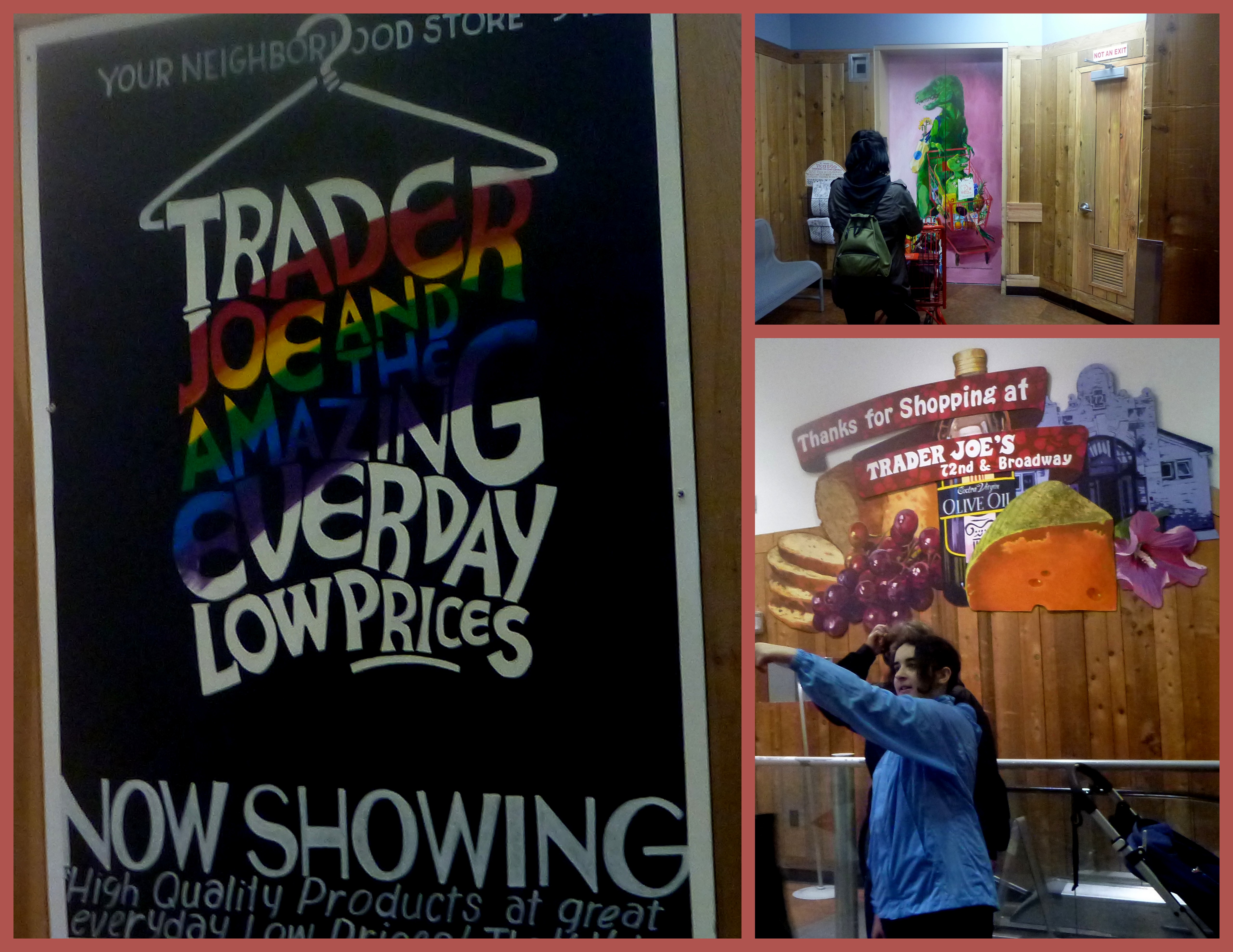
Trader Joes Upper West Side
We awoke again at 6:30am and took turns puttering around on the computer, showering and packing while Rachel dozed. Flor left for work early while I worked on emails and journal updates. They were both packed and ready to go when I started to pack. While they went below for Parisian Baguette breakfast treats, I showered and packed. I also spent some time ensuring that Flor’s laptop was able to boot and still run Microsoft Office applications. By the time I was ready, it was almost 11am, too late to meet Flor for an early lunch, so we left our bags in the apartment and went for another stroll in the wet streets with our raincoats on, enjoying a cooler morning after a light rain and the misty views of fog hovering over the skyscrapers.
Trader Joe’s was interesting with two underground levels. Chocolates and dried chile mango went into our stash for the long journey. We also snacked on some macarons right on the spot. Then we proceeded to explore Fairway Market where some unique Russian, onion, and sesame bagels found their way to form to another breakfast along with some wonderful ripe white peaches back at the apartment. The fare in the market was so impressive!

Street Signs
We finally left early and headed for the subway via Line 1 to Columbus Circle, transferring to Line B to Rockefeller Center. The Rockefeller Center Concourse wasn’t anything interesting that we could see, and was so warm that we doffed our raingear and headed outside to the fresh air, landing in a park across from the Villa Italia at 46th South between 5th and 6th Avenues where we had arranged a pickup by two luggage services. We passed the time guarding our packs and quietly observing the scene.

Hexagonal Waffle
We were ready when our Go Airlink van arrived a little early, and off we went, amazed at how many fun eateries populated this 46th Street neighborhood under the gleaming tower comprised of hexagonal prisms of glass. After one more pickup at the Grand Central Station accompanied by a guided tour by the driver, we rambled off to JFK while I followed the route on my roadmap. There was so much more to see, but we saw plenty, and were grateful for a restful day of easy transition.
We’ve been at the airport for many hours, checking in where they took two of our carry-ons as checked baggage — leaving me a bit insecure should they not arrive — clearing security where they confiscated the blade out of Susan’s razor, and eating at Tigin Irish Pub where Rachel and I each enjoyed a large Irish Breakfast with eggs, mushrooms, tomatoes, toast, and bangers, an assortment of sausages and ham.
It was a long day just getting to and waiting at the airport, which is why I prefer a late redeye or 6am flight. But, it was also nice to have a day without rush and a minimum of new impressions to digest. Yesterday was indeed full of impressions!
See you tomorrow! London is calling!

Mirror images

Le Cirque

Trump Tower

Puzzling reflections

Glass on Gothic
We arrived at 2am at Flor’s Upper West Side apartment on the 25th floor. I had a vivid dream of a strange place that was so real, I had to show it to Susan, which also turned out to be a dream.
It was early in the morning, and I got up before Susan and Rachel to greet Flor. Her door was ajar, so I called out to her and entered, noting that it had changed. Instead of opening into her bedroom, that door led to spacious tiled hallway that led up a ramp to a mezzanine level and down to a broad staircase leading below. As I climbed the ramp, it opened up to a spacious bedroom off to my right and a magnificent patio to my left. Flor called to me from outside, so exiting via glass doors onto the patio, I found myself descending through a broad fountain of pure tranquil water flowing away from the building. The water spread out at eye level as a flooded plaza until it opened to a fertile field planted as an orchard of miniature fruit trees. Off the side of the path, Flor stepped onto a depression in a gravelly terrace and slowly sank up to her chin in a spa of warm clay-like beads, claiming it was therapeutic and healing – her own private spa. I found another similar depression nearby and also descended, so enthralled that I was only mildly concerned about how I would get out. When I so desired, I was elevated upward and came out clean and refreshed.
Returning to the apartment, I had to bring Susan out and show her this marvel while Rachel continued to drowse in the present reality. I recall ascending the ramp with Susan and going outside before I awoke to the reality that this too was a dream. When I in truth shared this dream with Susan, Rachel, and Flor, they were astonished and we all had a good laugh.
Wednesday morning dawned very clear, no wind, and sunny. No one got up early as we only got around 4.5 hours of sleep and arose at 6:30am. We visited Flor for a while and presented our Wonderstone gift, discussed our plans, worked at un-installing the frozen Microsoft Office 2013 applications from her computer packed up for the day, and resumed our preparations. Beset with some obscure paranoia that she didn’t want to discuss, Rachel didn’t want to take her camera, fearing it would get lost, damaged, or confiscated, so I snuck it into my day duffel bag. I also packed sun screen, but it was never intense enough to actually wear, as we spent most of the day walking through shady parks and concrete canyons.

Organic
Our first stop was the roof, to see the view from the 43rd floor and gaze at the vista and rooftop patios and other architectural curiosities. Down to the street, we were enticed by the first Parisian Baguette bakery a block away and we munched our way along 72nd street towards Central Park. It seemed strange that so many shops were trying to draw customers by advertising “organic”.
Continuing up Central Park West, we missed Strawberry Fields and didn’t enter the park until about 78th Street at the top of The Lake where we entered the Ramble and joined the bird watchers cruising the park for finches, sparrows, cardinals, and orioles. Funny pictures of birders all gazing unitedly upwards at orioles caught my attention more than the elusive birds, and we got better pictures of common cardinals and starlings who were fearless in their approach than any of the more elusive avian passers by.

Birdwatching
The cameras came out to document the gothic architecture of the twin towers made famous by Ghostbusters, too far down on the street to appreciate the fanciful designs at the top.

Gothic Twin Towers on Central Park West

Central Park: The Ramble, Belvedere Castle, Turtle Pond
Climbing up and over the Belvedere Castle, the vista of Great Lawn and Delacorte Theatre evidenced the multiple uses of this urban parkland. Following footpaths up and over, around and through, there was a surprising amount of granite hills and riparian hollows as we wound past the Turtle Pond and up towards the Egyptian Obelisk.

Cleopatra’s Needle renovation

Reflections: Ghost Car
Circumnavigating the Obelisk, covered by scaffolding and under renovation, I crossed the parade of bikes and joggers and met Susan and Rachel where their trail crossed through a tunnel towards the back of the Metropolitan Museum of Art. Having walked slowly and carefully for 90 minutes with frequent stops, we arrived around 11am, too late for any worthwhile exploration of the museum, so we just walked around it snapping shots of spring blooms, glass pyramids, and peering into the north wing where some Egyptian statuary was visible from outside in the glass conservatory.

Judas Tree
Riding the subway to 59th Street and rambling around this neighborhood for an hour, we arrived early at the Sony Wonder Technology Lab and enjoyed their quieter open space with indoor seating. We stopped and Rachel purchased mascara at Duane Reade. We stopped to sit as often as possible, tired from our wending walk along the towers of Park Avenue and saturated with the intensity of close up meandering through the cityscape. Passing by a Green Café at 36 East 58th Street with a long queue out the door before noon, it was funny that this was precisely the 58th and Madison deli that Rachel and I later found at the moment when Carrie called us on the cell phone while standing in the doorway, so we hugged and laughed in astonishment that minds can work so alike, then loaded up with Panini and exotic fruit juices and carried lunch back to Susan who waited in the Sony Atrium. Along the way, we had passed through the candy section of FAO Schwarz famous toy store on a blitzkrieg photo op. We could have spent days shopping and browsing through so many interesting places, but I was sure glad to have a few minutes to just speed down the sidewalk weaving through people traffic searching for food!
Our visit over lunch was lively, as Carrie is such an articulate and interesting person. The technology labs were interesting, but explanations of how to use technology were often lacking, as children are already familiar with play station controls, and we were often puzzled at how to play the games without crashing cars, and how to collaborate on music mixing. During a brief 6 minute movie documenting the filming of freeze-action bunnies, I even got an impromptu nap! But it was all very interesting, and nice to focus on something in front of us, more structured, than all the random impressions of life on the street that inundates the senses and draws my attention to too many directions at once.

Over & Under

New York Public Library
Back on the street, we rambled about marveling at glass icons like the Trump Tower, killing time for two hours, happy to avoid some walking and taking a bus down to 42nd Street past the Rockefeller Center to tour the immense silence in the archival New York Public Library, with the Chrysler Building peeking out to the east. Entering the regular branch library, Rachel found a sought after manga in a special reading room and skimmed half of it before I urged her to go, while Susan and Carrie chatted. We stopped in Bryant Park for ice cream, taking in the quiet places where denizens seek solace amidst the frenzied pace. Avoiding predators in this place would be an impossible task if there weren’t peaceful enclaves where one could escape to gather in the safety of friends.

Shocking!

Time Square crowds
After walking past Times Square’s intensity where wrestling competition stalled throngs of tourists in the middle of the street, Rachel shopped for nail polish in Sephora, another huge beauty supply, and we were so happy to find another little park in the theatre district along 8th Avenue after dinner at the Kung Fu Little Steamed Buns dim sum, buns, and hand-pulled ramen noodle restaurant.

Real Kung Fu Little Steamed Buns Ramen
Our final trek covered three blocks to the August Wilson theatre where we had purchased tickets to the Jersey Boys Broadway show. We enjoyed the music, but cringed at the foul language and non-apologetic confessions of petty thievery, mob crime and immorality that accompanied the rise of The Four Seasons. Fortunately, Rachel was so weary, that she napped through the first half of the show, and was not perturbed by the language as much as we were. When did my little girl learn to tolerate such language? I guess she’s gotten used to that use of swearing in vernacular from her exposure to manga novels, but when used with intensity, I still hate it, especially when desensitized as entertainment. The show was fun and very professional, but too crude for my taste, and I will be much more selective the next time we get to view a Broadway show. Getting to sit for two hours after all the walking and zone out to the music was soothing after so much activity on the streets.
Carrie was turned around and sent us in the opposite direction, but we collided with her after realizing our mistake a block later, and headed for Line 1 which was only 3 blocks away and 3 stops from 72nd Street. And so ended a full day of gazing at towers and reflections in New York City.

Empire State beacon
Our trip to Europe started with a big Delta jetliner from Salt Lake City to New York City on Tuesday evening 6 May 2014. It was fairly full of an eclectic international crowd of many young and interesting people of all colors. Although I observed fancy headgear from turbans to yarmulkes, willowy red-headed performing arts women and striking black men, the couple in front of us dozing across two seats in a figure 8 with her perched atop of him, I was mostly numb from observing as the departure was time to rest from all the anxiety of lengthly preparations for a 5-week journey.
We were all smiles and confidence. Rachel snapped a hundred fly by cloud pictures, and has got to be nearing her card’s capacity already.
Landing at midnight, the transition at JFK went smoothly and a reserved shuttle brought us into Manhattan, bursting out of the Queensboro Midtown Tunnel, with the purple lit tower of the Empire State Building glowing like a beacon guiding us in. We wound through the east side from Rockefeller Center, 42nd Street, and Times Square before dropping us off on the Upper West Side at 2am.

Stealing the Light
Saturday 29 March 2014 – Four weeks since my last foray into the winter wilderness, I took to solo snowshoeing and hiking along Broads Fork trail for 3.75 hours from 4:30-8:15am from the 6,181’ Mill B trailhead to about 8,600′ at the base of the bowl where the trail normally ends at the 3 mile mark, ascending a steep 2,400′ in 2.5 hours for 800-feet per mile and descending quickly in 1.25 hours with time invested in dawn picture taking and removing snowshoes, and covering a total of 6 miles.

As the dawn advances
Packing the night before and arising refreshed at 3:30am, I was on the road at 4:05am and on the trail by 4:30am with a headlamp and snowshoes on a trail that was initially sparse of snow with frequent dry stretches. Using the MSR snowshoe extensions for the first time, they definitely helped climb deep powder, and made floating down on steep descents a new experience requiring additional vigilance, balance, and braking.

Remarkable Vistas in the Vale of the Mountain Kings
Reaching the end of the trail in the vale before the glacier, still covered in snow as a solid bowl, there were no avalanches apparent, nor ski tracks in the smooth bowl that received a fresh dusting a few days earlier (and again on the next day). I waited 5 minutes as the dawn ensued in a blustery wind, ate and drank a little, then descended quickly to the lip of the basin and paused again for the full alpenglow and pastel sky light show that lasted about 5 minutes.

Sunrise Trails
Only two 70-ish hikers and a solo young backcountry skier ascended during my descent, and I thoroughly enjoyed the wilderness, singing improvised prayerful lyrics to the tune of Les Miserables’ God on High, and feeling so alive. I had to doff my hats and shirts down to thermal top on the way up, but when I reached the upper vale a bitter wind caused me to don them all again, including the windbreaker. I doffed the snowshoes for the last ¾ mile of sparse snowy trail, and had a speedy overall descent.

Robinson’s Couloir
As usual, I came away supremely grateful that I made the effort and was so richly rewarded. I will be returning in August to climb the additional 2,700’ to the summit of Twin Peaks. Although I could easily see the ridge ascents to the Robinson Couloir on the Robinson Variation route of the north ridge of Twin, and the glacier was a smooth bowl, I would not want to trust those steep slopes without avalanche training. However, were I to camp in the vale at night, I would be tempted to ascend higher, and possibly crest the ridge and continue down behind Storm Mountain to Ferguson, but that is a lot of high country with no broken trails and I was grateful for the path I was able to break as far as I went without incident or risk, followed by a full and productive Saturday working outdoors in the garden in town.
Enjoy these rewards earned by arising before the dawn.

Au Naturel

Sunrise Reward

North ridge of Broads Fork Twin Peaks fiery summit

Sunshine on my Shoulders

Fire & Ice

Stealing the light of dawn

Many textures

Hello Sunshine!

Storm Mountain

Traversing Boney Ridge & Exporing Staircase Beach – Malibu 15 February 2014
Saturday 15 February 2014 – Solo hike traversing Boney Ridge covering 10 miles in 3.5 hours from 6:30-10:00am, starting at the 2,030′ Sandstone Peak Trailhead in the Circle X Ranch area of the Santa Monica Mountains National Recreation Area and ascending to the 3,111’ summit of Sandstone Peak, the highest point in the range, a gain of 1,081’ in 1.5 miles, then onwards along the Backbone Trail past the Tri-Peaks junction of Boney Mountain and 1.5 miles down the steeply descending Chamberlain Trail into Point Mugu State Park to about 2,000’ elevation, then back via the winding Mishe Mokwa Trail to the Mishe Mokwa Trailhead, plus about a mile of hiking back along Yerba Buena road. The morning started at 3:48am when I leapt out of bed in Laguna Woods and made a swift departure from Mom’s home in Laguna Woods by 4:00am. The 405 freeway from Orange County to the west side of Los Angeles was so devoid of traffic that I doubt there were more a half dozen cars per mile, so I wasn’t troubled by any of the congestion and eye-sores that burden this route, and I escaped through the McClure Tunnel at the terminus of I-10 onto a Pacific Coast Highway equally tranquil with frequent views of the full moon casting long reflections over the peaceful sea.
Pausing to view the source of a bright light offshore at Latigo Road, there was sailboat anchored in close, its mast-light bobbing merrily in the gentle heave. Stopping at Ventura County Line Beach to use the outhouse, another car drove up and disgorged four Japanese fishermen of various ages, all equipped with backpacks and poles, fully prepared for any contingency. Turning up Yerba Buena Road, I wound 6.5 miles past Cotharin Road and Circle X Ranch to the Sandstone Peak Trailhead just as the moon set behind the western ridges and the sun broke to the east with a magnificent display of fire.

Above the Haze
Before I relate the rest of the story, here are the rest of my favorite impressionistic illustrations.

Dawn’s Glow on Boney Peak

Echo Cliffs

There be Condors out there

Many Peaks

Yucca Flame

Signpost

Balanced Rock

Cautious Curlew

Pensive Willet

Tranquility

Tranquil Anchorage
Alone and at peace, I started jogging up the trailhead when another vehicle arrived, but that driver departed after using the facilities. A broad and rutty trail wound up and around the backside of the ridge, ascending towards to the summit, with frequent vistas of the peaks of Catalina, San Clemente, Santa Barbara and San Nicolas islands piercing the shroud of cloud that blanketed the ocean to the south, and similar vistas of smog shrouded inland valleys to the north and east. What amazing vistas from this stunning ridge of balanced rocks and pinnacles with significant prominence!

Circle X Ranch Map of Boney Ridge
Click to access CircleXRanch8-08.pdf

Dawn Vistas

Exchange & Boney Peaks

Islands in the Sky

Distant Channel Islands rising out of fog (clockwise): Santa Catalina, San Clemente, Santa Barbara, San Nicolas
The morning was so quickly warm that I doffed my long shirt and T to cool off from the exertion, and started in early munching on sweet Thai tamarind fruit. With the sun at my back, my frequent solitary morning companion cast a long shadow ahead of me, urging me to press on into shade as I rounded the backside of the ridge.

Preceded by my shadow’s long searching gaze
Any shadows that troubled me dispersed with my mine as I left the trail just below Sandstone Peak and scrambled to the top to sign into the register housed in a drawer in the monument dubbed Mt. Allen, the peak’s alter ego in memory of a beloved scout leader, W. Herbert Allen. It had only taken 50 minutes to cover 1.5 miles and 1,081’ gain to reach the peak, and I was a little cold with a mountain top breeze blowing upon mild perspiration.

Sandstone Peak (Mt. Allen) Monument & Register
Most of the journal entries in the register were trite, but I wish I had not only photographed my own reflections but also one that was poetic with deep introspection from a kindred spirit. The accompanying photo not only confesses how poor my handwriting can be, but evidences that I was cold and anxious to get moving again.
2/15/14 Gorgeous crimson dawn after full moon gleam on pacific waters soothes my searching soul whose long past anguish finds contentment and repose after 800 miles of wheeling to top a peak I dreamed of 45 years ago as a wakening scout. The channel island panorama beckons me back to the sea but I relish this moment anchored windy against the sky.
Sandstone Peak 7:30am
Ed Motola, 60
Salt Lake City, Utah
A denizen of long ago Santa Monica

Views from the top of Sandstone Peak
Gazing to the west, many bald mountain tops perforated the sandstone block with vertical prominence. Not far across the channel, Anacapa and Santa Cruz Islands loomed large and inviting, the yellow bluffs and curve of the shoreline clearly visible. Barely visible, the communications array atop Mugu Peak gleamed white 2,000’ below. I could see other hikers or trail runners starting to arrive at the trailhead way down below me, so I took off jogging in search of solitude along the ridge and back down to the Backbone Trail, diverted by each side track that led to some vista point or steep descent down a crack in the sandstone massif. After another 1.5 miles of passing Inspiration Point and paralleling the Water Tanks cutoff, I could see the Chamberlain Trail heading west across a ravine towards Point Mugu State Park, and desiring to see down into Serrano, Sycamore, and La Jolla valleys, I re-donned my shirts to protect me from the thick stands of Chaparral that I bushwhacked through, thus bypassing the junction of the Backbone and Mishe Mokwa trails, and soon came across the western terminus of the Tri-Peaks Boney Mountain trail in a very picturesque vale that wound between 3,010’ Boney Mountain and Boney Ridge comprised of 2,950’ Exchange Peak, 2,825’ Boney Peak, and 3,111’ Sandstone Peak.

Views of the top

Chamberlain Trail to Point Mugu State Park
The Chamberlain Trail quickly descended quickly through a tunnel of dense Ceanothus with occasional groves of the tallest smooth red-barked Manzanita and peeling red-barked Chamise I have ever seen, over 8’ tall, and obscuring the view of the colorful red and orange cliffs comprising the western flank of Boney Mountain. Gazing over the burnt out valleys down below, victims of an all-consuming wildfire of 2012, the massif of West Anacapa and eastern Santa Cruz islands loomed much larger across the channel than any of the other Channel Islands, rising in a westerly course as an extension of this Santa Monica range, separated by a submarine canyon and deep channel.

Sentinels
Losing a lot of elevation, I decided that I would see less vista if I proceeded in that direction, so I turned around and started back, regaining 1,000’ of lost elevation. Approaching the west Tri-Peaks trail junction, I had just come off another vista point lateral that looked down upon Circle X Ranch when I heard the first of a group of trail-runners, which spurred me into action to start back in earnest. For the next 1.5 hours, I jogged and walked the lower parallel Mishe Mokwa trail which follows a ravine below the crest through a shady hillside, across the cool riparian woodland at Split Rock, then up and down through the alternating slopes of side canyons as it steadily ascends back up the slope of Boney Ridge. Multiple day-hikers and rock climbers were now on the trail, and I could see some of them starting up the Echo Cliff escarpment below Balanced Rock.
I had hoped that I would see some wildlife while hiking solo in the early morning, but other than a variety of birds, there was nothing more dramatic than small blue-bellied lizards. Jogging and walking brought me to within a ¼ mile of the Mishe Mokwa trailhead, over 1 mile east of my origin, but instead of taking the trail up and over the ridge back to the Sandstone Peak trailhead, I decided to go the distance and see this other trailhead. It turned out that over a dozen cars were now parked at each trailhead. At last downing 8 ounces of water, I walked along the recently tarred road for a mile before I hitched a ride from some English-accented men with a friendly German Shepherd who dominated the back seat for the last ½ mile.
Pausing only to graze on chips and coconut water, I immediately started back to the coast. On the way down, I took Cotharin Road to Pacific View and down Deer Creek road to the coast through the complete desolation of the burn where nothing much has recovered yet. Along the Pacific View neighborhood of scattered homes, large signs denouncing tigers were frequent. I found a link in the internet discussing a dispute over plans by Wild Ones, LLC to house between two to five Bengal Tigers in their open space, to be used by the film industry. The dispute is still ongoing with articles published during the past week.
Plan to House Tigers for Movie Shoots Raises Concern in Malibu Area
http://www.ecorazzi.com/2014/02/14/sisters-want-to-house-5-bengal-tigers-near-malibu/
Reaching the highway, I cruised along slowly searching for new place to explore underwater. Although the best kelp is right at the mouth of Deer Creek, I was hoping to explore the rocky shoreline and choose a little beach just up the way where a stairway descended. Two other snorkelers were just exiting and various anglers were surf fishing. It took me while to rest and get ready, but I didn’t realize how much the hike had tired me until I got offshore and found that I just didn’t have my normal excess of energy to dive. I mostly hung out at the surface where limited visibility didn’t make for a great adventure. Other than beautiful anemones which would be exposed at low tides, and some large deceased sand crabs rolling around on the sandy bottom just beyond the mild surf, there wasn’t much to see in the gloom. I didn’t see a single fish, not even a surf perch. But the water was calm, and the ocean refreshing. If it hadn’t been that my legs and feet threatened to cramp several times, I might have persisted, but avoiding the pain and risk of leg cramps seemed the better part of valor, so I focused on getting back to shore only 30 minutes after entering the water and going no further than 100 yards up-shore.

Staircase Beach, Malibu
From there, I decided to look for a new beach, and discovered new accesses at Staircase State Beach at 14000 PCH along the Los Angeles-Ventura county line where new parking lots and trails led down to picturesque beach between the apartments north of County Line beach and the few homes that dot the bluffs on this stretch north of Leo Carrillo State Beach. Wrapped in a damp towel in a windy on-shore breeze, I hiked around both points to view a wedding in process which culminated in the couple mounting a white stallion and parading before their well-wishers, her wedding train streaming over the flanks of their ride. I also observed what appeared to be the same pair of snorkelers with giant fins that I had encountered earlier at Deer Creek, repeatedly diving down into the kelp bed 200 yards offshore. Longing to go back into the water, but knowing that I needed to reserve some energy for the long drive home, I took satisfaction in jogging along the sand and taking pictures.
High on a Mountain Top
Solo snow shoe on Saturday 25 January 2014 on Silver Fork trail for 4.75 hours from 6:10-10:50am, covering about 5 miles, from the 7,800 road head at the Silver Fork Lodge on Big Cottonwood Canyon Road to the Cottonwood Ridge Crest at 10,000′ between Davenport Hill and Honeycomb Cliffs, a gain of 2,200′.
After a surgical biopsy on Monday (results benign) and a full week of consulting concluded at Friday night at 8:00pm, I wasn’t sure whether I just wanted to rest on Saturday, or go for another adventure. But celebration was indispensable.

Silver Fork Trail
The trail in the dark was wide and easy to navigate as this is a popular spot for back country skiers to reach the Meadow Chutes, Flannigan’s, and Davenport. There was a bright crescent moon directly south and it guided me all the way in, hovering over Davenport Hill to the very end.

Sunrise, Moonset

Hot moon night beacon

Emerging into dawn

Early light

High on a Mountain Top

Alpine horizon

Mythical snow taking a bite of the mountain

Salt and Pepper Goodspeed

Presenting Mr. and Mrs. Goodspeed

Grins and Stand-offs

Photo Gallery

Tongues

Stilts not for jumping

Solo snowshoe on Porter Fork trail for 4.5 hours from 5:40-9:45am, covering about 6.75 miles, from the 6,000 trailhead to about 8,700′, a gain of 2,700′. This is becoming an annual event for the middle of January, formerly done solo or with Gary Myers on 15 January 2011 and 21 January 2012 from Millcreek Canyon’s Terraces picnic grounds to Bowman Fork to White Fir Pass to Pole Canyon.
This was my busiest week this season. I worked 59 hours this week, 20 hours straight on Thursday, so I went to bed early on Friday at 9:00pm. I’ve been waking up at 4:00am to start my day, and Saturday morning was no exception. I debated what to do with my day off, whether to take a hike or work on other projects. But on top of all the work, with Susie’s wedding and Mom’s visit this week, I know I won’t have another opportunity to get some solitude, so I decided to go trekking. In retrospect, I’m so glad I did myself the favor.

Rewarding Dawn
Snow shoeing in the dark with my headlamp on, there were clear skies with none of the customary city light reflecting off the low clouds. Gleaming stars pierced the night through the dense forest to lend perspective to the solitary mood.

Bowman Creek Splendor
I reached the end of Bowman Creek in 35 minutes, and the first switchback in 45, and White Fir Pass just after 60 (2 miles). The last time I hiked this trail in light snow and rain in slippery conditions, it took a full 2 hours to reach the pass. But today, the conditions were dry, and with no wind obscure my vision and cool me down, I was able to double my pace, and continue beyond my prior limits. The entire trail, from the road head and the access road to Terraces picnic area was dense with snow, an easy hike on snow shoes. The Porter Fork Trail was mostly packed except for some slumps along the upper switchbacks, but beyond White Fir Pass, I was breaking an easy trail since the last storm’s accumulation. But beyond the crossing of Yellow Jacket, the elevation and powder depth sank me 6-12″ with each step, and I could thrust my trekking poles at least 3′ into the off-trail powder.

Winter Palette
A lone hiker, Barry, caught up to me at the crossing of Yellow Jacket. He broke trail for a while, then I took over past the Alexander Basin cutoff and onwards beyond the crossing of Pole Canyon. Getting too deep for him, he was post holing up to his knees even through my steps, so he turned back around 7:30am while I pressed on, as the pink sunrise showered us with the grace of grandeur. I was climbing steadily through an open forest of Aspens when the trail, previously a trench visible through the snow, petered out on the mountainside, and I only got another 100 yards in deep powder, knee-deep with each short step, before I too turned around at 8:20am and reached the pass at 9:00am. Where I turned around, I was probably only 200 yards from the flat where Baker Spring flows, about 1/4 mile above the Alexander cutoff, having covered about 3.35 miles from the trailhead in 2:40. I estimate that I reached 8,700′, a gain of 2,700′.
I’m going to have to look into snow shoe extensions or cross country skis in order to traverse this higher and deeper snow. I passed several cross country skiers during the 40 minute jog back to the pass. They were angling along the hillside above the trail on a traverse that would lead them to Alexander Basin. Their smooth tracks packed the trail and increased my speed, such that even with multiple photo op stops, I covered the last 2 miles down in 45 minutes, totaling 6.75 miles in 4.5 hours, a respectable average of 1.5mph.

Winter sketches
The fairyland of snowy woods, the solitude and dawning light, birdsong and flicker chatter, blue skies and majestic alpine vistas, all combined into a most rewarding adventure. Near the trailhead 25-30 snow shoers, presumably Wasatch Mountain Club, stood aside as I jogged on past. Other snow shoers and cross country skiers dotted the trail, making for many greetings. “Leaving so soon?” one asked. “It’s been a long night,” I inferred.
Back at home, I had fun editing in Picasa, making the most of the pictures to bring out the contrasts.

While vacationing in Laguna Woods after Christmas, the highlight was the sea kayaking off Crescent Bay with Dan DeVault and Irene Foss-Richards. On Friday morning, Dan picked me up in his Toyota pickup at 7:30am with his two fiberglass kayaks. After loading Irene’s turquoise Ocean Kayak on her Toyota SUV, we caravanned down Moulton to El Toro to Laguna Canyon Road, then down to Circle Drive and the north Crescent Bay access where a half dozen divers had emerged from a morning plunge. The conditions were absolutely flat calm and lake-like: no surge, surf, swell, nor wind, and warm sunny skies.

Sea Lion Rocks, Crescent Bay, Laguna Beach, CA
We pushed off easily at 9:00am and headed way offshore beyond the Sea Lion Rocks, out to where shearwaters and porpoise were fishing the shelf.

Longing for Catalina
Catalina commanded the horizon and beckoned us to take a long paddle, but we reveled in this place and time together amidst many other kayakers and stand-up paddlers.

Picture perfect conditions

Dan amidst the shearwaters

Celebrating 60

Exploring above and below
After an hour of paddling around, I donned snorkel gear and dove in onto a 30′ bottom over Dead Man’s Reef with 15-20′ tall rocks forming a wonderful reef with abundant kelp. The visibility was easily over 30′, probably 60′, and there was no current nor turbulence and limited suspended particulate matter. I took a lot of pictures with ambient light and flash, and some were salvageable. At first, my ears wouldn’t clear, and I did some damage forcing them to relax, which healed after two days.

Blades

Fire and light reflections on kelp
Fire and light reflections on kelp
Snorkeling down 20-30′, I wasn’t able to hover long enough to focus in in the minutiae, but the fish bowl and kelp forest were fascinating. A sea lioness zoomed past in graceful poses, and pelicans soared overhead.

Submarine skies
Schools of Blacksmith (Chromis), Opal-eye (Girella), Halfmoon (Medialuna), and Seniorita wrasse (Oxyjulis), graced the water column along with Sheepshead (Semicossyphus, formerly Pimelometopon), Garibaldi (Hypsypops), and Kelp Bass (Paralabrax).

Fish bowl

Garish Garibaldi

Big wrasse, Little wrasse
Southern Sea Palms (Eisenia), Giant Kelp (Macrocystis), Feather Boa (Egregia), and many forms of lesser encrusting red algae festooned the rocks along with white and orange sponges, abundant mussels, rock scallops, bryozoa, tube worms, urchins, and diverse anemones. Big fat ochre stars (Pisaster) bulged with gullets full of mussels.

Encrustacea on Dead Man’s Reef

Translucent

Southern sea palms swaying in the breeze
Paddling on back to Shaw’s Cove and all the up to Laguna Beach at the Canyon Road, we glided over the Eelgrass and Feather Boa in the shallowest of zones where the turbulence normally precludes any views, glorying in conditions that let us explore the pacific clarity of the immediate subtidal behind the absent breakers. Rippling sandy bottoms and big boulders form a fairyland all along this shoreline, where surf perch and baitfish dominate the shallows.

Warm glass
But after three hours, it was time to rejoin the family, and we stuck perfect landings and hauled out. It was a perfect day, halcyon conditions in Southern California.

Lashing kayaks

With barely enough backlight to illuminate the golden glow of maple keys, this photo has been highly contrasted to illustrate the mood.

Highly colorized and contrasted thickets shout their rage against winter’s oppression.

A natural arch formed by a bent sapling forms a passage through Wonderland.

Only the heat signature can reveal the contrast between shadowy cliffs and snowy ridges against a dusky sky.

Heavily highlighted, I’ve forced some sunshine into this cliff edge shrub.

Colorful cliff bands have been drawn out in this colorized photo.
Solo snow shoe in Ferguson Canyon Saturday 21 December 2013 – I was up at 4:20am. I was on the trail by 5:20am, so bright with the city lights and snow and low clouds, that I didn’t use my headlamp until I was deep in the canyon and having difficulty finding the unused trail beyond the switchbacks to the overlook.

On a grey morning, a frosted pine is decorated for Christmas just a days away.

The view from the overlook is blue on grey.
It was a stunning canyon, heavily wooded, festooned with thick coating of snow, and very vertical with granite cliffs.

One cannot appreciate the majesty of this rock outcropping from this dismal photo, but it was indeed grand.

Flocked with snow on all surfaces, this heather against rock rests in gloomy morning shadow.
I got past the double knobbed ridge peak, and although the trail should have gone further, I couldn’t find the buried trail, and it was getting harder and harder to plow my own path through steep, deep powder.

There is color, but the mantle of white covers all.

Wisps of long grass pierce the blanket of snow.
Altogether, I snow shoed Ferguson Canyon from 5:20am-9:10am from the 5,300′ trailhead on Timberline Lane in Cottonwood Heights, Utah, to about 7,000′ elevation where the trail beyond the switchbacks rejoins the creek about 2 miles in, a gain of 1,700′, plus a .15 mile side spur to the overlook, for a total of 4.3 miles, up in 2.5 hours, down in 1.5, with lots of photo stops. A most rewarding morning!
But when I reviewed the pictures, I was surely dismayed. Have you ever looked back on your wilderness pictures to find that they turned out lifeless and grey when your recollection of the adventure was full of hope and confidence? The reality didn’t fit your mood? How is it that a grateful attitude can overcome oppressing overcast and inspire wonder despite the smothering smog of inversion’s heavy gloom?

Passages through thickets
These pictures of Ferguson Canyon in winter’s grasp came out totally grey, with little contrast between the snowy ground and the grey sky, no slanting sunlight to accent the dawn, nor moon to illuminate the night.

Inserting Contrasts
Even though the narrow canyon was lined with fantastic cliff bands and the vistas of the valley’s twinkling lights and the canyon’s craggy walls were marvelous to behold, the lack of contrast on film did not recall the emulsion impressed on my memory. I have had to highly alter these pictures to draw out color and contrast.

Illuminated Illustrations
So listen for the unseen splendor. Feel the comfort of the frosty silence. See what you did not imagine.

Cliff Contrasts
Exult at the wonder of the dripping seeps forming icicles, the exhilarating crunch of snow shoes on crust, and feel the rewards of laboring to break trail through deep powder.

Listen! This photo does no justice to the timpani of drips and drops.

Can you hear the rain of the sping forming icicles in the grotto?
I will have to return and push to the upper basin another 1.5 miles beyond my terminus. Who will come along to help me break trail?

Late on a Friday night
Long Lake
Island Lake
Bucket list
Hayden Peak ridge
Saturday 24 May 2013 above Ogden, Utah
Hike with James Workman from 7:15am through noon for 4.75 hours from the North Ogden Divide Trailhead at 6,170′ elevation to a point on the ridge below Chilly Peak at about 8,470′ elevation, for a total gain of 2,300′ over approximately 9 miles, averaging 1.5mph. We ambled up the wide winding trail of switchbacks up the southern crest at a leisurely pace, and quickened the pace once we reached the flatter multi-purpose trail carved under the ridgeline, and eventually jogged along the grand vistas on the west facing trail leading to Chilly Peak. The day was glorious, and although we got a bit later start than usual, the heat of the late morning on the way out wasn’t overwhelming on this spring day as it will be later in the summer. Everything was green, green, green, and the pastoral views of Liberty, Eden, and Huntsville surrounding Pineview Reservoir were so amazing, as were the steep cliff-edge drop-offs to suburban North Ogden and the panorama of Wasatch front to the west, with the Great Salt Lake, Willard Bay, and the multiple impoundments of the Bear River Migratory Bird Refuge clearly outlined, and the skyline dominated by Ben Lomond Peak to the north, and Mt Ogden to the south.


Passing a lot of green annuals not yet blooming through dense slopes of maples with translucent emerald early leaves and rusty red scrub oaks with infant leaves, we first encountered big bright yellow stands of mature Mule Ears composite, and a few obnoxious Dyer’s Woads, which I broke off at the base. Violet-blue vetch, dark blue Larkspur, Scarlet Gilia, and cerulean Pentstemon dotted the open areas of the trail until the trail darkened under the north-east facing slopes under a thick stand of firs and some persistent snow banks turned away the lone motorcyclist who dared the trail that morning. Stopping to eat on the saddle below Chilly Peak where a narrow slot still bound in winter white plummets down off the ridge, we posed for pictures. Only half-way to Ben Lomond Peak, we made plans to return for an overnight backpack from Liberty to North Ogden and Willard peaks, and looping down to James’ home in Willard.


Hiking down along the ridge tops with their fields of multicolored lichen-crusted slate, we encountered a strong wind from the west, and festive fields of blazing yellow wallflowers and asters with red Indian Paintbrush and pink lady slipper. On the rounded crests of ridges recently liberated of their snowy blanket, the season is still early so there were thick stands of the nodding yellow Glacier Lily and recumbent blue-pink phlox. Miniature yellow Tumble Mustard and Nuttall’s Violets with their telltale striped throats, as well as rosettes of pastel blue forget-me-nots dominated the rockier ridge tops.


Alpine carpets of Glacier Lily and Nuttall’s Violet
We talked about a lot of things, and I learned a lot about James penchant for the French Language, the Occitan language in particular, the medieval history of the Languedoc region, and the 12th century Albigensian Crusade against ascetic Catharism, which backfired and eventually resulted in the formation of the ascetic Dominican and Franciscan Orders. I also caught up his migrations from Medford, Oregon to Huntsville and Willard, Utah, his infant sons, George and Matthias, his recent graduation with a Bachelor of Arts in French from Utah State University in Logan, and plans to move to London, Ontario, Canada for five years of higher education to gain his Masters and PhD at the University of Western Ontario so that he can become a Professor of French. Hot footing it down past late morning families, young couples, YSA groups and scouts who oft inquired if made it all the way to the top, I replied that we went as far as we had wanted, as we both noticed that our feet were feeling the burn. Whereas James felt the steep climb on his calves on the way up, he was equally aware of the burn on his quads during the ridgeline descent, but it was all good exercise. I advised him to stay alert after this training hike and stay active the rest of the day, but after a drowsy hour-long drive home to Salt Lake, I retired to a 3-hour nap and spent the rest of the day relaxing and playing backgammon with Susan and Daniel. After so much demanding work lately, including working until 10pm the night before, I really enjoyed this Saturday holiday.

Saturday 16 June 2012 Solo hike of Broad’s Fork Twin Peaks from the Mill B Trailhead in Big Cottonwood Canyon from for 11 hours from 8:20am-7:20pm covering 9.6 miles with an elevation gain of 5,300′ over 5.1 miles in 5.2 hours from 8:20am to 1:30pm and an elevation loss of 6,100′ over 4.5 miles in 4.75 hours from 2:40pm to 7:25pm, with 70 minutes resting and crossing from one peak to the other. Susan delivered me to the Big Cottonwood park and ride lot at the mouth of the canyon where I was supposed to meet Pam Miller and her Wasatch Mountain Club friends at 8:00am, but she wasn’t there and wasn’t answering her cell phone, so concerned that we had miscommunicated about which parking lot to meet at and that she had meant the trailhead parking lot at Mill B (thus the lack of cell phone signal), I had Susan drop me off up the canyon. We didn’t find her there either, so after praying about it, I felt impressed to press on and try to catch up to them on the trail, so I departed the 6,190′ trailhead at 8:20am behind 3 other groups that had just started: a duo, a trio, and a soloist. Pushing myself up the hill to the Beaver Ponds in 70 minutes (half the time that I did it 2 weeks previously with Pam), I passed all three groups, and headed west around the ponds. I met a lone hiker in his 60s who had left at 7:15am and reached this point, claiming that there were no other hikers ahead of him. I continued along the trail that I assume heads up to the Robinson’s Cutoff ascent of Twin Peaks from the northwest, then veered off cross country back to the east onto the northeast trail that follows Broad’s Fork when the duo and the trio passed by me below. Along this primitive and seldom used trail that petered out, I found a water bottle which I deposited back at the trail, and a gaiter which I claimed to replace the one I lost in May in Red Pine Fork. Watching constantly for signs of Pam and other hikers coming up from the ponds, I donned chains and started the ascent of the snow field, about 1/4 mile further up than 2 weeks ago, while the duo followed the treacherous creek along the cliffs below me to the east. Only a few other male hikers followed up up. Reaching 9,400′, a lone hiker zoomed up and passed me by, and I last saw him at the pass, and I don’t think he was in trio plus one that were descending just as I reached the summit. The duo, Adam and a woman who is landscaper and hikes a lot, tagged along with me about 15 minutes behind.

The ascent of the last cirque southwest of the head of Broad’s Fork below Sunrise to the pass was very steep, and all of us used the same tracks to stairstep up the dense snow. Stepping off onto rock 20′ below the pass, I slipped into a crack and scrapped my shins through my slacks, but it could have been worse. It took me a while on the sharp pass to regain my balance, fascinated by the views from 10,800′ on this knife edge of the Cottonwood ridge overlooking both Cottonwood Canyons, the Alpine Crest, with Timpanogos looming behind, and the High Uintah’s on the horizon. The water roaring down White Pine, Red Pine, Maybird, and especially Hogum Fork could be heard from this summit. I called Susan at 12:26pm to report that it had taken me 4 hours to reach this high pass, and that I would press on and call from the Twin Peaks summit. I stopped to feed, hungry after no breakfast and little snacks with only some supplements and green drink in my belly. I had definitely slowed down once I started the steep ascent from the head of Broad’s Fork, taking 3 hours to reach the pass from the beaver ponds. Scrambling the ridge was challenging, especially the ascent up a crack to the base of the East Peak, and took another hour, but I wasn’t in a rush along this dramatic divide. The views were stupendous! It was a clear cloudless day with no fires, so the clarity was perfect. I could see north and east to the red scar of Big Mountain Pass, and the scar under Grandview Peak in City Creek Canyon. The Wasatch north to Ogden and Logan and Promontory point and the expanse of the Great Salt Lake impressed me as I could see white beaches to either side of Promontory Point where the left beach is the Spiral Jetty. Looking west over the Oquirrh’s to the Granstsville peaks and beyond, I was likely looking at Deseret Peak. The south view was blocked by the Apline Ridge mentioned previously, and Traverse Mountain and Bluffdale looked miniscule. Peering south and southeast, I had clear views of the Alpine Ridge from the Snowbird Tram summit, American Forks Twin Peaks, Red Top, Red and White Baldy’s Pfeifferhorn, Thunder Ridge, and Lone Peak, with Mt Timpanogos looming above and behind. East along the Cottonwood Ridge, the views over Dromedary and Sunrise onto gleaming Lake Blanche and a diminutive Sundial ridge, with little view down into Mineral Fork, and much of Monte Cristo and Cardiac Ridge dominating the vista beyond. North and northeast, the length of the Millcreek/Cottonwood ridge was far below, from Mt. Olympus along the Hellcat ridge to Mt. Raymond, Gobbler’s knob, and the Wasatch Crest from Mt Murdock to Mt. Clayton. Over these, Millvue peak beyond that, the familiar transmitter-tower peak beyond Kimball Junction, and the High Uintah skyline on the horizon.

Visiting with the duo on top of the 11,330′ East Twin peak, I decided to take the Deaf Smith descent west off of West Twin (11,328′), and called Susan to report my plans at 2:40pm from West Twin, expecting to descend in 3, possibly 4 hours. Boy, was I wrong! It took another full 5 hours! Following the instructions in the guide the duo had lent me, I followed a southwest descent off West Twin peak into a basin that eventually wound north and back into Deaf Smith. The upper basin was fun and easy, but Deaf Smith was a pain. The trail was intermittant, and I searched frequently on both sides of the creek to regain the faint path, cutting through a lot of sparse shrubbery and burned out timber on a rough descent through multiple hollows. At one point, I spooked a rattler, and I squealed as I jumped aside, but he was too fast in his retreat for me to get a shot. About 1.5 miles from the mouth of the canyon, I followed a side trail near a trashed campsite to a high point where I could see the valley and get a signal at 5:40pm, advising Susan that I would be down by 6:30pm. I called her again at 6:45pm to report that it would take another hour as I cut through the plunging curves of Deaf Smith gorge, often in the water, until I finally met two hikers with three dogs about a mile from the trailhead. I immediately lost the trail again, but soon figured it must be on the south side, and managed fairly well from then on despite many times when the trail disappeared under debris and landslides, dumping me back into the creek. I reached the trailhead off of Golden Hills Canyon Road at Kings Hill Drive at 7:25pm. Before I called Susan, who was parked at the end of King’s Hill Drive, I dug out my water pouch to drink the last dregs. She brought me two 28oz bottles of Gatorade, and I quickly downed one. This is the first time in a long time that I packed a full 2.5 liters of water in my Camelpack, and drank it all. I didn’t finish all my nut mix, but the chocolate was consumed in stages on at the summit and the descent. We spent the evening at the Venture Outdoors festival with Rachel. I slept from 9:30pm until 3:30am, then started writing this account. My feet are sore from several sharp rocks and all the miles, but not quite hamburger. I only roll a little…
Greg Lyman had time for an early morning hike this morning, but David wasn’t ready until the evening, so I got two hikes, interspersed with hours working in the garden. I got to hike every weekend and holiday this month, from snowy ascents with chains to ordinary hikes, extraordinary for the vistas and solitude.


Saturday 5 May 2012 (Cinco de Mayo) hike with Pam Miller for 4.75 hours from 6:05-10:50am covering 7 steep miles with a gain of 3,600′ from the 4,850′ trailhead to 8,450′ at the saddle. This was the first of many training hikes to come in preparation for her July ascent of 18k Mt Elbrus in the Caucasus. We didn’t force the pace this time, just found a comfortable one, with me still recovering from a cold. With multiple photo stops and adjustments to clothing we reached first-water in 55 minutes, took a 5 minute food break, then pushed steadily onto to the saddle for a 2.5 hour ascent, with one lone trail runner who started off when we did already coming down 15 minutes before we reached the top. We also met three campers who had spent a cold night. It was a little cool up there with a breeze, so we put gloves and another top layer back on, but there were hardly any shallow puddles of snow left anywhere. After a 10 minute break overlooking the craggy heights of Wildcat Ridge and the headwall of Heughs Canyon, and pondering the access point of the distant trail we could see on the far side of the canyon, we started down at 8:40am came down steadily to a few turns above first-water where I paused to tighten my shoes. Feeling better, we picked up the pace, but my right knee was killing me for the last quarter mile. We reached the bottom at 10:50am, a 2.25 hour descent, as we strictly avoided the knee shattering temptation to run. We passed many hikers on their way up throughout our descent, and noted the changing mood of the day, from overcast with drifting foggy clouds and a few light sprinkles in the morning, to sunny and clear in the afternoon. The constant booming that bodes thundershowers was probably some construction project, not thunder. The hills were green with fully leafed scrub oak, baby leaves on all the maples, but nothing on the dormant aspens yet. There were ample stands of wildflowers and much birdsong in the lower canyon, and I was amazed to be hiking in verdure after so recently been trekking through continual snow. A hiker, who had been up last weekend, claimed that there had been 2′ of snow all along the staircase. Pam, who keeps her eyes on the trail, couldn’t remember having passed some of the landmarks during the less intense descent, while I paused frequently to observe the cliffs and crags along the opposing walls of Tolcats Canyon, and other benchmarks along the way. This trail seems far less daunting to me now, but I am concerned that my knee hurt even though we took a careful and determined pace, with care to step heel-to-toe. Views include the ascent along the trail along Tolcats Canyon and from to the saddle overlooking the head of Heughs Canyon, with vistas of the angular backbone of Wildcat Ridge and the snowy cloud-shrouded peaks of Big and Little Cottonwood Canyons to the south.
 After a weekend snorkeling in Laguna Woods and a quick round trip to Mexico City to deliver a Coton de Tulear puppy to my cousin, Lily Saltiel, it was time to catch up on the garden. I missed a few weeks on the trails while I battled 20′ tall rose vines at the duplex and did other maintenance there. I may have lost the battle — I wore scars for two weeks — but I won the war. Any spare time has spent repairing the watering systems and sprinklers at my house, and laying in the garden. Yesterday, I planted a Mulberry Bush, and tomorrow, I plant the rest of the seeds.
But the winter camps and showshoe ascents of the past winter haven’t quite ended. Following the March and April ascents of White Pine Fork and Bells Canyon to approximately 10,000′ elevations, Pam Miller asked me to challenge her to reach some heights in preparation for her July ascent of Mt. Elbrus, 18,000′ in the Russian Caucasus, the highest point in Europe. Despite my annual cold, and fighting a urinary tract infection, we met at 6:00am for the four Saturdays in a row. We first tackled the steep 3,600′ ascent of Mt. Olympus to the saddle, then we donned chains and crampons to climb frozen hard-packed snow 2,300′ into Red Pine Fork where I managed to climb to a point on the ridge below Thunder Mountain overlooking White Pine Fork at 10,000′ elevation, and lost some gear out of my pack. We returned the following week and I found some of my gear while crossing from White Pine back into Red Pine Fork. We capped off our May treks with an ascent of Broad’s Fork towards Twin Peaks, climbing nearly 1,000′ on a mile of icy snow.
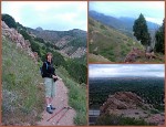
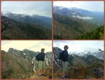


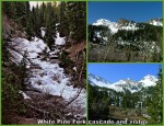


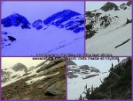

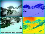

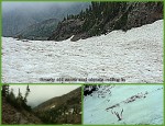
Ever since I started down this road to outliving cancer, I’ve been living life more fully. 18 months ago, I decided that the fulfillment I was enjoying hiking in the wilderness wasn’t going to end with the onset of winter. Equipped with Yak Traks and snowshoes, I started exploring throughout the winter. Urged by an enthusiastic conspirator, Gary Myers, this entry chronicles 18 months of snowscape escapes. Accompanied by Gary, and occasionally my children, I’ve become more daring in my ascents, often going solo so I could push myself to alpine crests before dawn. In between were many hikes at lower elevations and in warmer climes, as well as family trips to the seaside, desert, and mountains–car touring, timesharing, and backpacking–from the western states to the Yucatan Peninsula.
During this time, I have recovered from two rounds of cancer excisions in my neck and palette, and have done a lot of therapy and cleansing to boost my immune system and eliminate my proclivity to develop cancer. I have not been as diligent as I should have been, but I have worked hard at it, and I’m grateful for all the fulfilling memories. 6 months after my last surgery in December 2011, my most recent MRI in May 2012 was free of cancer.
The camera has followed me to give me focus and recall when I’ve lapsed into complacency. Here is a chronicle of adventure and fulfillment in few words and many pictures. Only a few of these photographs are presented in their natural light. Most have been edited with Picasa to make the most of the color and contrast, and are presented in collages to maximize the impact. Come celebrate with me!

- Saturday 13 Nov 2010 Solo hike to Mt Olympus saddle in 4 hours from 5:00am to 9:00am covering 7 miles with 3,600′ gain from the 4,800′ trailhead to the 8,400′ saddle. Racquetball gets me going Monday, Wednesday and Friday mornings, but I yearn for the trail. So the odd days in between are all calendared for an Early Hike. I manage one out of five reservations, so that about every 10 days, I’m up at 4:00am and on the trail by 5:00am. About half way into the trek in silence, dawn materializes and the headlamp is stowed, which is fortunate because although the ascents are at a determined pace, the post dawn descents require a clear view of rocky trails as I run down in half the time.

- On this day, I took on the steepest trail close to home, capping off a great hiking season before I’ll have to resort to snow shoes and cross country skis. The Mt Olympus trail soars from the foothills to the saddle under this prominent rock which has the steepest eminence of any of our local peaks. 7,000 feet gain, then loss in 3:30 hours:minutes, 2:15 struggling higher past increasing ice, powder, and new falling snow, then an increasingly fast descent back to dryer ground in 1:15. The two other times I’ve raced along this trail (15 years ago and 2 years ago), my knees complained for days, and a nap was de-rigueur. This time, I hardly stopped moving as I spent a full day completing projects around home for 14 more hours. Pardon me if I boast, but I must be getting stronger. Four days later, I toured for 8 days around Mexico City.


- Saturday 25 December 2010, Christmas Day, short solo hike from Mill B North Fork trailhead at 6,200′ in Big Cottonwood Canyon on Yak Traks with views of Wildcat Ridge. The Yak Traks are great for scrambling on frozen rock, but I need shoeshoes to meet the trail.
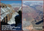


- Friday 31 December 2010 solo hike on the Bright Angel Trail at South Rim of Grand Canyon–While on our way home to Utah after a week hiking and working from a Sedona, Arizona, timeshare while Daniel passed some gallstones, New Year’s Eve found me at the Grand Canyon on the day after a big storm (which we weathered in sunny Phoenix). We had a long drive ahead, but the opportunity demanded a break from driving. While Daniel napped, I took a hike at noon covering 4.0 miles in 1.5 hours, below the rim with Yak Traks the day after a big storm on Bright Angel Trail from 6,800′ to about 1,300′ below the rim, a mile short of the 3 mile resthouse. Donning Yak Traks, I ran down the first 2 miles and trudged back up, 1.5 hours round trip from the rim to almost the lower edge of the snow a few thousand feet below. There were weary backpackers exiting and other day hikers going in both directions, but very few people compared to what this popular pack trail carries in season. This is a descent like no other! How I longed to keep going!
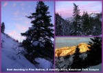
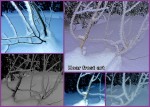


- Saturday 8 January 2011 snowshoeing with Gary Myers from the Pine Hollow trailhead for 6 hours from 7:00am-1:00pm covering 9 miles with 2,200′ gain. My first snowshoe with Gary, and the first of many excursions from this trailhead. Starting at Pine Hollow trailhead in American Fork Canyon at the winter terminus of the Alpine Loop road (UT-92) above Mutual Dell campground, we trekked 7 miles up Pine Hollow through several meadows to a summit along the Ridge Trail, then down to Summit Campground and Salamander Meadows, then 2 miles down Willow Hollow. The hoar frost was spectacular!

- Saturday 15 January 2011 snowshoeing on the Bowman Fork trail for 5 hours from 7:30am to 12:30pm traversing 5 miles with 2,400′ gain from 6,000′ to 8,400′. Snowshoe with Gary Meyers in Millcreek Canyon from the Terraces picnic ground along the Bowman Fork trail to White Fir Pass and on to Pole Canyon. Tranquility personified along Bowman Fork contrasted with grand winter vistas of the steep face of Raymond Peak. We descended cross-country through the bottom of Yellow Jacket Gulch to Porter Fork and back to Bowman Fork via cabins 4abc. We had hoped to reach Baker Springs, but breaking trail uphill on the progressively steeper slopes of Gobbler’s Knob wore us out. Breaking trail down the steep slopes of Yellow Jacket was a grand adventure in deep powder! I returned a year later in worse weather and got no further. A winter summit of Baker Pass still awaits.


- Saturday 5 February 2011 snowshoeing with Gary Myers and Daniel Motola on the Shingle Creek trail off Hwy 150 for 4 hours in a snow storm from 8:00am-12:00pm, an easy creekside round trip with minimal elevation gain, covering 6 miles from 8,000′ to about 8,800′. We went searching for fresh powder at higher elevations, but this highway ends before one gains much altitude. Nevertheless, Shingle Creek is a perfect destination for snowshoeing along a scenic creek with minimal elevation gain.
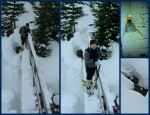


- Thursday 24 February 2011 snowshoeing on the Shingle Creek trail with Gary Myers for 5.25 hours from 8am-1:15pm covering 9 miles with 1,500′ gain from the 8,000’ trailhead to about 9,500’ elevation. Returning to Shingle Creek in the Uintah foothills off Hwy 150 and aiming to reach further, we broke trail for 1.5 miles up into the Shingle Creek narrows. Aiming further and higher, trekking 9 miles seems to be our limit, especially when breaking trail, but we still aim to return and reach the lakes. This snowshoe was enjoyed a week after a Snow ‘n Sun President’s Day weekend in southern California where I enjoyed hiking 10 miles in Santa Anita Canyon and snorkeling at Crescent Cove.

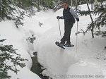
- Saturday 5 March 2011 snowshoe from Pine Hollow with Gary Myers for 3.25 hours from 8:30-10:45am covering about 6 miles with 1,100′ gain. More trekking around Pine Hollow to the upper meadow and the ridge on a moody day where the sun didn’t shine and the snow didn’t fall. Good powder and grand vistas.

- Saturday 12 March 2011 snowshoe from the Broad’s Fork trailhead with David Motola from the S curve of Big Cottonwood Canyon at Mill B for 3 hours from 11:00am-2:00pm for about 2.5 miles gaining 1,000′ from 6,200′ to about 7,200′. A steep ascent to no particular prominence, we trekked for three hours, including a cross-country descent and ascent back to the trail. Fun and tiring!

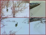
- Saturday 2 April 2011 solo hike cross country to Little Mountain peak for 1.5 hours from 12:30-2:00pm covering about 3 miles from the Dimple Dell Reservoir parking lot at about 5,900′, then straight up 1,100′ to the ridge and traversing to the 7,032′ broad summit, then down to the highway and back to the trailhead along the icy road. A week after cancer surgery, I needed a break from recovery. I took a short hike between LDS General Conference sessions from the end of the East Canyon Road above Dimple Dell reservoir to the crest of Little Mountain. Leaving home at noon, I drove only 30 minutes, then hiked for 1.5 hours, stumping into snow at the ridge, gaining 1,100′. The vistas from this mid-canyon ridge beckoned me to higher elevations, but this was perfect for the time alloted. The grouse was a special treat!


- Saturday 23 April 2011 solo bike and hike into snow in City Creek Canyon for 6 hours from 5:00am to 11:00am covering 15 miles. Following 5 days to Glenwood Springs, Colorado Springs, Moab, and Arches with Beckie, I took a solo bike ride for 11 miles round trip from the Terrace Hills trailhead in the Salt Lake Avenues down into City Creek and up to Rotary Park. Then, I hiked with Yak-Traks the last mile of snowy road plus one mile of trail past three red bridges in soft snow, post-holing. I could have really used my snowshoes! I couldn’t find the trailhead to Smuggler’s Gap that heads steeply up to the Little Black Mountain Trail. I returned the same way. This adventure has been colorized to accentuate the Kodachrome pigments of this pinnacled watershed.


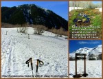
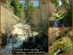
- Saturday 7 May 2011 hike with Gary Myers to Sagebrush Flats on the front range of Mt Timpanogos for 5.25 hours from 6:15-11:30am along 8.25 mile loop from Grove Creek Canyon trailhead at 5,250′ elevation to Battle Creek trailhead at 5,200′ along the Shoreline Trail, then steeply up and across the bench and back down Grove Creek trail, gaining 2,350′ to 7,550′ elevation. It’s a good early season hike as it is just demanding enough to be of physical merit and it loses its snow earlier than most of the area. Surprise! We hit 2 miles of soft snow on the bench, post-holing without snow shoes. We could have used the snow shoes and would have cut an hour off the 5 hours. The falls and cascades were stunning, but the most amazing thing was the force of multiheaded springs gushing out of the ground and forming instant cascades and rivulets that merged with force into a unified stream.


- Thursday 26 May 2011 solo hike before dawn in Neffs Canyon for 3.33 hours from 4:20-7:40am covering 5 miles with 2,400′ gain from 5,600′-8,000′ . Cloud cover reflections at night illuminate better than a full moon. Trail was snow free until after third water. Climbed snowy southern ridge along big creek coming down into Neffs Canyon from Wildcat Ridge following a deer trail. Quick descent down steep snowbanks, with panoramic view of upper Neff’s cirque from headwaters of “Wildcat Creek”. This was the first of 3 treks every other day at the end of May.


- Saturday 28 May 2011 hike with Pam Miller up the west face of Mt Grandeur for 3.75 hours from 7:30-11:15am covering 4.5 miles with 3,300′ gain from the 5,000′ northern terminus of Wasatch Blvd south of Parley’s Canyon, ascending the west face of Mt Grandeur to the 8,299′ summit. The ascent covered about 1.7 miles in 2 hours, resting 15 minutes at the top. Overcast and cloudy, blowing wispy clouds at the summit with oscured views, the warm descent through a snowy summit with Yak Traks into Church Fork with lots of runoff took 1.5 hours to cover 2.8 miles and a 2,600′ drop to the 5,700′ trailhead. Descent into Millcreek Canyon required a little downhill care through snow on the summit, exiting via Church Fork with a shuttle vehicle.


- Memorial Day Monday 30 May 2011 I hiked and snowshoed with Gary Myers to Dog Lake from the Mill D trailhead in Big Cottonwood Canyon for 7 hours from 8:00am-3:00pm covering only 6 miles with 1,300′ gain from 7,300′ at the trailhead to a point around 8,600′ about a half mile beyond Dog Lake where we were navigating without sign of the trail in 3′ of fresh powder. Following a last big storm over the Memorial Day weekend, we ascended from the Big Cottonwood side in chains until we reached 3 feet of fresh powder. I broke trail up the steady hill for 3 miles, but Gary broke a snowshoe, forcing us to return the way we came, unable to loop via Butler Fork. We chided ourselves for having given up on snowshoeing in March. I wanted to go light and cover this entire loop, so I took no camera. The emulsion of my brain remembers how alive I felt. These are Gary’s shots of me celebrating.

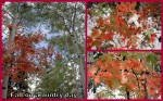


- Saturday 8 October 2011 solo hike with chains and snowshoe in Big Cottonwood Canyon’s Mineral Fork for 4 hours from 11:00am-3:00pm covering 8 miles with 2000’ gain from 6,800′ at the roadside trailhead to an elevation of about 8,800′ in the upper basin. Following 4 months of stunning summer hikes and a month touring 2,500 miles of southern Mexico with family, the winter hikes got off to an early start on Saturday after a big fall snow storm. I didn’t go with the Utah Great Outdoors group (UGO) to Mt Nebo in this weather. This was a specular ascent into a glamorous basin with full fall colors draped in snow. I had total solitude with nary a soul in sight except a solo bow hunter on 4-wheeler whom I met on the way out. I’m amazed this machine could pass through the rocky narrows near the bottom of the trail. I saw no game animals, just a stunning alpine basin, old mines, and rusty creeks polluted with mine tailings. There is much more to explore in this basin, particularly in the winter when hunters are less prone to interfere.

- Friday 14 October 2011 hike to Highline Ridge with David Motola for 6 hours from 7:30am-1:30pm covering 3.5 miles with only 1,000’ gain in 1.5 miles. I had been wanting to ascend cross country from this trailhead into the Middle Basin, and this was my last chance before winter set in. Traversing east on a contour from the 10,000′ trailhead in shallow snow, then straight up a north-south ridge towards the mesa between Mt Agassiz and Hayden Peak, we climbed steadily until cliffs at 11,000′ barred further progress. We hiked in 1’-2’ of crusty snow, often breaking through, boulder and rock hopping when possible. Starting on frozen crusts going up, snowdrifts of powder at times engulfed our entire legs on the slopes, and slush at the meadows hampered our progress coming back. Snow shoes would have helped at times, but we did it in wool socks and tennis shoes. We didn’t reach the summit of the mesa, but made a brave attempt and enjoyed magnificent vistas of the Granddaddy Lakes Basin with sweeping views to the west and south. I side-swiped a deer on the drive up and fried eggs for breakfast in the car at dawn, and Mountain House stroganoff on the mountain.

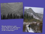
- Saturday 12 November 2011 hike and snow shoe from Pine Hollow to Timpooneke Trail and Bear Canyon with Gary Myers for 5 hours from 7:00am-12:00pm covering about 9 miles with 2,500′ gain from Pine Hollow trailhead to first meadow, then over past the Salamander Flat campground and across the Timpanogos Loop road and past the Timpooneke campground and ¾ mile up the Timpooneke Trail, then back down to the Timpooneke trailhead and up and over to the head of Bear Canyon, down to Mutual Dell, and back up to the Pine Hollow trailhead. About 9 miles with 2,500 elevation gain, up and down and up and down and up and down again, about 3,500 total gain. Started out as a hike until just beyond the first meadow, then snow shoeing until half way down Bear Canyon. Rain at lower elevations in the valley pushed us up to the highest trailhead where blowing snow greeted the dawn, adding little to the scant 6” base that was sufficient to make snow shoes advantageous. Beautiful views popped out of the clouds as we approached and entered the Mt Timpanogos ascent. Some bird calls but no wildlife, and few hikers (Velo Club and 1 other solo hiker), contributed to the winter splendor as we ascended through late fall into deep winter, awed to find 90 year old signatures on Aspens along trail 179 descending Bear Canyon. Cloudy and moody, it wasn’t a good day for pictures. Spent the afternoon putting up mirror with Corinna and Erik, followed by a family dinner with Mom, Susan, Rachel, Daniel, Susie, David, Molly and Isaac.

- Thursday 17 November 2011 early morning solo hike and snow shoe from Bowman Fork to White Fir Pass out of Millcreek Canyon for 3 hours from 6:00 to 9:00am covering 5 miles and 1,500′ gain from 6,100 trailhead to 7,600′ at pass. Came down off White Fir pass cross country along ridge then dropped 800′ back to Bowman Fork. I was contemplating an overnight camp on Friday with Susie on this same trail, then on up ot Baker Pass on Saturday, but Susie wasn’t up to it. Very peaceful morning.

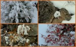
- Saturday 19 November 2011 hike BYU Y and into Y canyon with Susie Motola and Jeremy for 3 hours from 8:30-11:30am for about 3.5 miles with 2,200′ gain from 5,200′ base to 7,400′. My first trip to the BYU Y was interrupted by calls from Susan and Rachel’s melt down. Susie had no energy. We observed some crazy hikers going cross country on the opposite bank, exceeding their limits and capacity.


- Thursday 24 November 2011 Thanksgiving Day hungry hike on packed snow before Thanksgiving meal with Susie and friends from Singles Ward: John, Tai (Iranian PhD candidate), Jeremy and big brother Greg. Hiked for 4 hours from 8:15am-12:15pm covering 8.25 miles with 3,132’ gain. Reached peak in 2.5 hours from 4,744′ trailhead to 7,876’ summit, with 3,000 drop and spectacular views. Used gaiters for the first time, but didn’t need them. Shared dolmas and flax crackers. With 30 minutes in two breaks, Susie led the way to the top with tons of energy, and we ran down in 1 hour.

- Recovering from another cancer excision on 5 December 2011, I took a short snow shoe with cousin Betto Nolla Saltiel from Mexico City on Saturday 17 December 2011 on the ridge leading from the winter terminus of the Guardsman Pass Road overlooking Brighton. Starting at 6:30am at 9,000′, we ascended about 500′ in an hour then came down in 30 minutes. I didn’t have he energy to push much further. We toured Solitude where he skated artfully on their vacant ice rink.
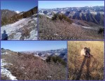
- Saturday 31 December 2011 hike Little Black Mountain trail with Greg Lyman and Dennis Watson for 4.25 hours from 12:45-5:00pm covering 9 miles gaining 3,200′ from the North Terrace Hills Drive trailhead at about 4,600′ to 7,793′ elevation at the false summit benchmark and mailbox. Cold, sunny, dry, but icy on slopes, we reached the summit in 2.25 hours versus a 1.5 hour solo in June. I found a blue Bears cap at the postbox, which gave my head some warmth on the way down. What grand views rewarded us on the last day of the year. As always, I enjoyed the company of these good men. The pictures were taken with my cell phone.

- Saturday 7 January 2012 snowshoe with Gary Myers for 2 hours from 2:00-4:00pm parallel to Soapstone Canyon and along Soapstone Road FS 39, from end of Mirror Lake Hwy 150, to junction with FS 144, covring about 2 miles and 700’ gain at the 8,000′ level. Cross country trekking going up and mostly on the road going down. Cloudy and sunny, with fresh powder and very quiet. Snow blowing up from red cliffs in Soapstone Canyon were the highlight.

- Saturday 21 January 2012 solo snowshoe and hike along Porter Fork for 4 hours from 8:10-12:10am covering about 4.9 miles. An anniversary trek formerly done with Gary Myers on 15 January 2011 from Millcreek Canyon’s Terraces picnic grounds to Bowman Fork to White Fir Pass to Pole Canyon (3 hours for 2.65 miles), then out cross country through the bottom of Yellow Jacket Gulch to Porter Fork and back to Bowman Fork via cabins 4abc (1 hour for 2.25 miles). Millcreek Road still had black ice at 8:00 am in light rain, so I had to slide crawl across roadway to start. The Terraces road was so icy that I walked in margins on the way up, and in runoff on the way down. I reached the end of Bowman Fork at the base of the switchbacks at 9:50am in 1:40 minutes for 1.2 miles wearing chains. It took another 40 minutes to reach total of 2.00 miles in 2 hours with snow shoes to the top of White Fir Pass with light snow. Blowing light snow for another 0.9 miles hampered my vision, and the goggles were useless as they quickly fogged up. I reached the ridge between Yellow Jacket and Pole Canyons for a total of 2.65 miles in 3.00 hours at 11:10am. With cold hands after only 5 minutes eating lunch, I turned around and headed cross country down Yellow Jacket in deep wet powder, then used a sled disc to slide down much of Porter Fork road in increasing wetness. During the final 1/4 mile down Terraces road, I was shipping water into the disc as I slid down the runoff trench which was manageable whereas the icy road was too fast. Took no pictures in the inclement weather until the last half mile exiting Porter Fork to Terraces. This was followed a week later by 9 days and 1,500 miles in January and February touring the altiplano of Mexico City and the 9 surrounding states with daughter, Susie Motola. We were unable to ascend the Iztaccihuatl volcano due to the extreme fog.

- Friday 10 February 2012 a brief sunset hike with Pam Miller and Anne Polinsky for 45 minutes from 5:15-6:00pm on the lower trail of Mt Grandeur with only a skiff of snow off the trail.
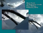


- Saturday 18 February 2012 snowshoe from Tibble Fork to Ridge Trail with Gary Myers for 8 hours from 8:15am-4:15pm covering 10 miles with 2,100′ gain from 6,400′ at Tibble Fork dam to a summit of 8,500′. The first leg covered 3.5 miles of broken trail to the Ridge Trail summit, then took the challenge of going onwards for 2.5 miles (including cross country) of breaking trail to the top of Mud Springs trail and onward 2.5 miles back to the junction, then completd a figure 8 with 2.5 miles of broken trail down Mill Canyon. My feet hurt from so much downhill trekking for last two miles. This was a gorgeous sunny day where I got to doff a few layers on the sunny slopes. Photo ops were supreme.
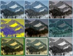


- I had too much fun playing with this picture in Picasa of the backside of Timpanogos North Peak!


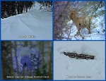
- Saturday 3 March 2012 snowshoe with Gary Myers for over 7 hours from 8:40am-4:25pm, less 1 hour assisting an ATV get unstuck from the bottom of Silver Lake Flat Reservoir. Covered over 9 miles gaining 2,150′ from the Tibble Fork Reservoir trailhead at 6,400′ to the narrows leading to Upper Silver Fork Lake at about 8,550′ elevation. The first 3.5 miles from Tibble Fork Reservior to Silver Lake Flat Reservior at 7,550′, plus 1 mile beyond the lake, was endured amidst the intermittant whine of snowmobiles. But the last 1.1 miles of the 2.1 miles (1,000′ of the 1,460′ gain) from the lower Silver Lake Flat reservoir towards the upper Upper Silver Lake, was solitude on unbroken trails. Indeed, since we paralled the road on the trail, we broke trail in 2′ of snow for 3 miles from Tibble almost to Silver Flat dam, then again for 1 mile in 4′ of heavy snow to within 1 mile of the upper lake. Up in 5 hours, down in 2, I lost a hat and gloves between the lakes. We could have pushed further and longer, but the heavy snow hampered our ascent, and discretion seemed the better part of pushing our limits. Too bad, as this was the end of the season for Gary.


- Two solo snowshoe adventures in the White Pine Fork of Little Cottonwood Canyon–Saturday 17 March 2012 snowshoe in White Pine Fork for 5.3 hours from 4:40-10am covering about 8 miles with 2,100′ gain from the White Pine Trailhead at 7,700′ to a 9,800′ ridge crest in the midst of the canyon on the west side of White Pine Fork north of Thunder Mountain (10,718′), with views up to rim below White Pine Lake. Leaving the trailhead well before dawn on cross country skis for 1 mile to the White Pine/Red Pine trail junction, then continuing cross country via snow shoe, I reached my terminus on a ridge below White Pine reservoir in 3 hours, then down in 2.3 hours. I originally crossed the footbridge and thought I was going to cross over to the Red Pine Trail, but ended up following tracks straight up the west side of White Pine Fork through the forest and open glades, then straight up some very steep cirques. I reached the knob where I stopped with approximately 60mph winds, pelted with snow liberated from the ground, so I stopped and came back down. Never having hiked in White Pine Fork, I thought that maybe I had crossed into Maybird Gulch and was looking up at Pfeifferhorn’s pyramid, but reviewing the map later, I concluded that I was gazing up at the Thunder Mountain on the divide between White and Red Pine Forks, also a pyramid. I didn’t realize I was in White Pine until I came across the switchbacks on the old 4-wheel trail on the east side of the canyon, which was not the way I came up, having followed the stream initially. I couldn’t ski down effectively, so I walked last 1/4 mile. Trail conditions were good in the pre-dawn, but already slushy at lower elevations coming down mid morning, especially with a broken basket. Starting at higher elevations and early in the morning definitely achieved the goal of encountering good conditions at higher elevations. I returned a week later for an overnighter on Friday 23 March for a snowshoe and overnight camp in White Pine Fork for 6.25 hours of trekking from 9:20pm on Friday night through 8:40am on Saturday morning, with about 5 hours break and 4 hours of sleep. Covering about 14 miles with 3,100′ gain from the White Pine Trailhead at 7,700′, I attained my goal and reached the 10,800′ ridge on the Alpine Crest wall between Little Cottonwood Canyon and the American Fork drainage, at a coll below White Baldy Peak above White Pine Lake on the Little Cottonwood side, where a sheer drop of 2,000′ to Silver Glance Lake on the American Fork side demands respect. On Friday night, I covered the first mile to the White Pine/Red Pine trail junction in 25 minutes, then continued at a slower pace on a steeper ascent until midnight on the White Pine trail on the east side of the canyon to a 9,400’ campsite at the edge of the trees at the bottom of the lower cirque with views up to Thunder Mountain. The hike was warm, with just 3 layers below and 3 above, balaclava and gloves, having removed my outer shell on the way up. I camped fully dressed 3×5 layers with a cap and a balaclava and gloves and booties in my bivvy sack with a 2-lb down summer bag on an air mattress. The wind wasn’t too bad, just occasional blasts of frosty air and blowing snow, cold at first, teeth-chattering, then warmed up the clothing and was warm, but never comfortable in the confined space with condensation and woke every 15 minutes for 3.5 hours, with cold feet. I ate a chocolate bar at 3:30am, then my bladder forced me to get up and going. At breakfast on Saturday morning 24 March, I took supplements and re-hydrated, then broke camp at 4:20am with my bivouac fully stashed, but left the backpack behind and went on with just minimal supplies in a belt pack and camera slung over my shoulder. The trek up the first cirque was somewhat familiar, following alpine skier tracks that had frozen more solid and compressed, ascending the east slope to get to higher ground to the ridge below White Pine Lake. Then, I continued up the upper cirque above the lake, progressing along the west wall to the final summit on the coll below White Baldy Peak at 5:50am. In serene solitude, the view, even in the dark, was stunning, on a 5′ wide rocky ledge and another 5′ of cornice which I deigned to test. The drop-off to American Fork Canyon and Silver Glance Lake is a sheer 2,000′. Above me loomed a craggy and steep ascent to the peak, and down and across the narrow ridge was the bulk of Red Baldy, with American Fork Twin Peaks looming above on the horizon. Mt Timpanogos was just a distant shadow in the dark, seemingly smaller and below, but the lights of Heber and Daniels shone out in the darkness to the east, and Sandy City glowed over the shoulder of Shadow Mountain to the west, with the massif of the Big Cottonwood crest to the north. Night pictures can’t do justice to the grandeur. I depart at 6:00am and stayed too high in the basin, but finally descended to my base camp at 7:00am and spend 30 minutes eating and catching the alpenglow of the sunrise on White Baldy and Twin Peaks and Sunrise Peak, then followed the western creek trail down to the junction and out by 8:40am. Covering 4 miles on Friday night, plus 3 up on Saturday morning, then 7 miles out, I totaled 14 miles with 3,100′ gain and a 5 hour break, for a total of 6.25 hours of trekking. I reached my goal, to reach the summit ridge on the wall. I would have stayed longer, but I had an assignment to help the scouts collect contributions for the food bank at 9:00am. I spent the afternoon with David and Molly, Susan and Rachel, attending the well-baby checkup for Isaac with Dr. Joseph Humphreys, then stops at Wal-Mart and Rancho Market to pick up pre-fab furniture for Molly, produce, and lunch at Rancho, then napped, then raked leaves at duplex, inspected exterior of units, washed and vacuumed Vibe and garage, and stowed the camping gear. I ended up with dinner and a movie at home (The Ideal Husband), and chats with Mom and Susie.

- Friday April 6 – Saturday April 7 Solo night hike, camp, and snowshoe trek in Bells Canyon, for 9 hours from 8:30-11:30pm on Friday and 6:00am-12:30pm on Saturday covering approximately 13 with 4,600’ gain from the 5,200’ trailhead to my trail terminus at 9,800’. This was my first foray into Bells Canyon, and my second snow camp, this time with a tent instead of the bivvy sack. My feet were cold and woke me up every hour for 5 hours of sleep from midnight until 5:00am. Night Ascent–The day after some fresh snow, I left the 5,200’ trailhead near Wasatch Blvd off 9400 South in Granite at 8:40pm dressed light with two layers and summer hiking boots carrying a 25 pound backpack with snowshoes, boots, tent, sleeping bag, pad, belt-pack, camera, snacks, and water. After my last overnighter two weeks prior in White Pine Canyon, I was determined to stay warm, thus I packed a bigger synthetic bag and the 3 man tent instead of the confining bivvy sack and light summer down bag. Besides, it’s time to get used to carrying a pack again for this summer’s backpacking. After about 20 minutes, I met one lone hiker coming down off the reservoir with a headlamp on. At the reservoir, I stopped to don another shirt, balaclava, headlamp, and gloves because my fingers were seriously cold in the breeze by then. The lamp wasn’t necessary, but it did help to avoid the puddles. I probably passed the Bell’s Canyon trail in the dark and continued on towards the trail past the powerhouse at the inlet. From this juncture, I followed a trail up into the canyon to a signed junction that pointed “Trail” to the left, which it turns out was the regular trail that I had missed. After two minutes descending on this trail, I unpacked the map, got my bearings, turned around and continued on up. From that junction, the trail started to have intermittent snow on the edges of the trail, increasing as I reached the wilderness boundary sign and the bridge, but the snow helped smooth the rocky nature of this trail as it steadily ascended. About 10:30pm, two miles in, I reached a hard left turn in the trail and started descending towards the sound of the lower falls. Still carrying the pack, I descended until I could make out the lower arc of the falls in the dark, then climbed back up and realized that no one had ascended the trail beyond this point. Kick-stepping up a steep ravine in about 6” of powder, I broke trail for another hour traversing across a narrow snowy gulch, and finally taking to the trees to see if the trail was on the other side of the ridge to my left. Returning back to the gulch, I finally pitched camp at about 6,800’ at 11:30pm on a tiny flat about a half mile above the falls, 2.5 miles up from the trailhead. I never heard the upper falls. I did marvel at the glow off the walls, especially the Bell Towers which glowed in the moonlight. Looking up for the source of the light, I saw the full moon cresting the ridge through the trees, a brilliant yellow orb. Strangely, it disappeared behind the ridge, and I never saw it in the morning. It must be cutting a very low angle to have remained behind the ridge.

- Camp–Pitching the tent went swiftly, as did filling the air mattress, but my bare hands were getting cold. Hauling out the camera, I took some shots of the valley lights at midnight, far, far below. Somehow the camera had turned on and had used up the batteries, so I had to reset the date and time, but forgot to reset the film quality from the default of 1 Megapixel to 6M until the morning. Strangely, I don’t recall ever changing out the batteries, and they’re still holding a charge after flash photography. Stripping down to garments, I put on my thermals, long sleeve T-shirt and pants again, and flannel shirt on top, and eventually the balaclava and soft flannel mittens, while I made a pillow out of my shell in the pad’s stuff sack. I put on a fresh pair of wool socks and wore both pairs to bed, but I slept fitfully with cold feet, waking every 15 minutes to toss and turn. It was a quiet night with no wind, just weary and unable to sleep soundly, though I got sufficient naps. My left big toe was sore and cramped, but there was no way to sufficiently massage and warm it. Finally, at 5:00am, I had to use empty my bowels. That woke me up and I started eating a chocolate bar while I got warm in the bag again, and I dozed intermittently until 5:45am, then dressed and hit the trail at 6:00am to the tune of an owl hooting repeatedly nearby. During the long night, I fell asleep to constant prayer often, seeking rest, but no greater enlightenment or blessing. I was content to just be present and experience the now. No other thoughts or concerns intruded, and that is the blessing of wilderness. It demands full attention and allows no other intrusions.


- Morning Ascent–I was so surprised to find that there were fresh tracks from a pair of alpine skiers just past my camp. They were not there the night before, so someone passed me by early this morning. They made a bright trail to follow up and into the wilderness and made my passage much easier, not having to break trail. Their gait was steady, with nary a break, and I stretched to match their stride with my poles. Pausing in the flat about ¾ of a mile above camp, my feet were really sore, with a sore left toe and an achy right arch from an ill-fitting sock. I wondered about the wisdom of continuing on up if my feet were going to be so sore. Finding a log on which to sit, I removed my boots, adjusted my socks, replaced my boots, and reattached my snowshoes, and felt much, much better. Indeed, I felt renewed and continued steadily onward and upward, crossing the stream shortly thereafter (3.5 mile mark). My goal was to climb out of the canyon into the cirque below North Thunder Mountain (Thunder Mountain Bowl), which glows so prominently white from the valley to the west of the Lone Peak ridge. The sunrise broke the shadow off the higher peaks, illuminating more and more of the Alpine Crest and Thunder Ridge and Lone Peak. From this altitude, I could see over the unnamed ridge 9,177’ peak that overlooks precipitously from Bell’s Canyon down onto Little Cottonwood Canyon.

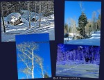
- Descent to Camp–Apparently, these other outdoor enthusiasts had the same goal as I did, and cut a swath of switchbacks up the steep slope up towards the tree-line ridge on the north slope of Bells that runs up towards the bowl. It was steady climbing with nary a flat knob to stand on. By 9:00am, I had climbed from 7,800’ to about 9,800’ above Bell Canyon and headed up into the Thunder Mountain Bowl following the fresh alpine ski tracks before me. Tucking into the canyon that runs behind the unnamed 10,488’ peak that lies in the midst of the canyon below the bowl and above Upper Bells Canyon Reservoir, my parting views were at an equal level over of the opposing 9,600’ ridge that runs north off of Lone Peak. Although I longed to continue onwards, I had family plans for this afternoon, and it was time to head back down. I left the terminus of my trail at 9:00am and reached camp 10:25am, returning in half the time. I switched the cell phone back on, and it was almost out of charge, even though I had left it off. Somehow, it turns on even though the button is hard to activate. I called home and advised Daniel that I was heading down from camp. From this, I estimate that my quick descent took 1 hour and 15 minutes, having taken a break to take a self-portrait with timed release in flats at 10:00am. Coming down at an average rate of at least 3mph, I estimate that the distance from camp to my trail terminus was 4 miles, making the entire ascent a total of 6.5 miles. How the entire trail to the Upper Bell Canyon Reservoir is rated at only 5 miles beats me, but perhaps it’s all the added mileage and effort of crisscrossing up the steep slopes towards Thunder Mountain Bowl that added all the mileage.


- Descent from Camp–I took another 20 minutes to eat and break camp. Swallowing my morning supplements, I struggled with the Magnesium capsule which lodged sideways in my throat. Taking a deep breath while imagining if I was going to choke and die from a pill, I swallowed more water and managed to muscle it down. By now it was warm enough that I stowed away my shell. I left camp around 11:00am, following the skiers and my own combined track down the steep trail, surprised to realize they came up behind me and passed me by and I never heard them. They put on their skis not far above where I had doffed my summer boots and put on my winter boots and snowshoes. I was surprised that there was no less steep trail, and even more surprised that they were able to traverse up this same steep slope on skis where I was barely able to climb with crampon-aided snowshoes. Reaching the junction at the falls, a lone hiker started down while I packed my snowshoes and shirt. I wish I had paused to take a daylight look at the falls, but I was too anxious to get down and didn’t think about it until now. I passed many hikers on the way down, mostly couples, but some families with children. I found a tent stake and stowed it in a pocket, reluctant to drop the pack again which was starting to get uncomfortable on my shoulders. I paused to chat with one gentleman about my age who tucked in my sleeping bag stuff sack cord which had been intermittently snagging on shrubbery and stowed the sharp tent stake in a pocket. Shortly thereafter, I hit the reservoir road junction. Overheating with too much winter clothing on a warm sunny day, I finally paused to doff gloves, shirt, and thermal shirt, and get back down to 3 layers below and 2 above. Ignoring sore feet, I trekked on and reached the trailhead at 12:30pm and stopped to change out of my winter boots and back into my damp summer boots. I called Susan home at 12:40pm after I plugged the phone back into the charger and started driving.
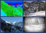

- We spent the afternoon doing yard work at Susie’s in Provo. I let Susan drive the van and napped on the way down. Not surprisingly, even for me, I slept for 12 hours last night. Today was Easter Sunday.


- Saturday 14 April 2012 solo snowshoe in Bell’s Canyon for 9 hours from 5:00am-2:00pm covering 12.5 miles with 4,000′ gain from the 5,200′ trailhead to an elevation of 9,200′ at my trail terminus. Instead of going overnight, I hiked into the lower falls at 5:00am, then donned snowshoes and plowed onward breaking new trail into the upper basins, reaching a point about 600′ below my previous terminus, too tired to go on. Exiting was easy, but the ascents were very steep and difficult without packed tracks to follow, especially on slopes with fresh, light, deep powder. The sunnier slopes were crusty on top, but heavy to lift my shoes when I would break through. Although I enjoyed the challenge and covered 12.5 miles all in one go, I have yet to reach the Thunder Bowl. I’ll try again in Spring after the snow melts off the lower trails. Amidst clouds and serenity, I bid a fond farewell to winter trekking and enjoyed the birdsongs that were airing merrily. I enjoyed seeing the lower falls in the daylight, and took a cutoff to the north Bell Canyon ridge on the way down before the lower reservoir, hiking cross country along narrow ridges through old tracks and game trails.


